Latitude: 51.1036 / 51°6'12"N
Longitude: -2.3289 / 2°19'44"W
OS Eastings: 377065
OS Northings: 133861
OS Grid: ST770338
Mapcode National: GBR 0TV.L0W
Mapcode Global: VH97Z.LJ4B
Plus Code: 9C3V4M3C+CC
Entry Name: The Iron Bridge
Listing Date: 9 September 1987
Grade: II
Source: Historic England
Source ID: 1131103
English Heritage Legacy ID: 321260
ID on this website: 101131103
Location: Bonham, Wiltshire, BA12
County: Wiltshire
Civil Parish: Stourton with Gasper
Traditional County: Somerset
Lieutenancy Area (Ceremonial County): Wiltshire
Church of England Parish: Upper Stour
Church of England Diocese: Salisbury
Tagged with: Bridge
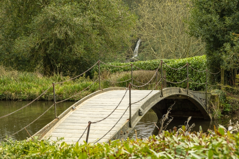
STOURTON WITH GASPER STOURHEAD GARDENS ST 73 SE (west side) 6/154 The Iron Bridge GV II Bridge carrying footpath over west arm of Garden Lake. 1860 by Maggs and Hindley, replacing an oak bridge of 1840. Single shallow segmental arch with decorated spandrels, wooden walkway, iron stanchions holding chains. Erected for Henry Ainslie Hoare, 5th Baronet. (K. Woodbridge, The Stourhead Landscape, 1982)
Listing NGR: ST7706333863
External links are from the relevant listing authority and, where applicable, Wikidata. Wikidata IDs may be related buildings as well as this specific building. If you want to add or update a link, you will need to do so by editing the Wikidata entry.


Other nearby listed buildings