Approximate Location Map
Large Map »
Latitude: 54.4773 / 54°28'38"N
Longitude: -1.5526 / 1°33'9"W
OS Eastings: 429086
OS Northings: 509201
OS Grid: NZ290092
Mapcode National: GBR KJLN.NS
Mapcode Global: WHC63.3QXG
Plus Code: 9C6WFCGW+WW
Entry Name: Tees Bridge
Listing Date: 29 January 1988
Grade: II
Source: Historic England
Source ID: 1131366
English Heritage Legacy ID: 322661
Also known as: Croft Viaduct
ID on this website: 101131366
Location: Croft-on-Tees, Darlington, County Durham, DL2
County: Darlington
Civil Parish: Hurworth
Traditional County: Yorkshire
Lieutenancy Area (Ceremonial County): North Yorkshire
Church of England Parish: Hurworth
Church of England Diocese: Durham
Tagged with: Railway bridge
CROFT-ON-TEES A 167
NZ 20 NE
(east side, off)
8/22 Tees Bridge
- II
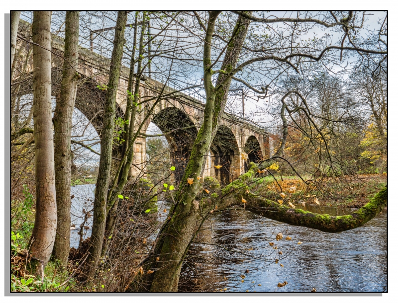
Railway viaduct carrying 2 tracks over River Tees. 1838-41, designed by
Henry Welsh for the Great North of England Railway Company. Sandstone
ashlar. About 100 metres long. Both faces similar. 4 segmental skew
arches on slightly battered piers which have projecting low rounded
cutwaters with shallow-domed tops. Sunk decorative panels with roll-moulded
borders on faces; chamfered impost bands. Narrower section of wall breaks
forward above each pier and has a similar sunk panel with dropped keystone.
Arch tunnels, voussoirs and spandrels have chamfered rustication. Flat-
coped horizontal parapet, defined by 2 stepped bands at track level, breaks
forward above piers to form rectangular-plan pedestrian refuges, some now
destroyed. Parapet end piers have low pyramidal caps. Late C20 parapet
railings. Rendered embankment-retaining walls. Partly in the Civil Parish
of Hurworth. K Hoole, A Regional History of the Railways of Great Britian,
Vol 4, The North East, 1965.
Listing NGR: NZ2908609201
External links are from the relevant listing authority and, where applicable, Wikidata. Wikidata IDs may be related buildings as well as this specific building. If you want to add or update a link, you will need to do so by editing the Wikidata entry.


Other nearby listed buildings
