Approximate Location Map
Large Map »
Latitude: 54.0126 / 54°0'45"N
Longitude: -1.922 / 1°55'19"W
OS Eastings: 405209
OS Northings: 457400
OS Grid: SE052574
Mapcode National: GBR HQ01.PB
Mapcode Global: WHB73.GD0Q
Plus Code: 9C6W237H+26
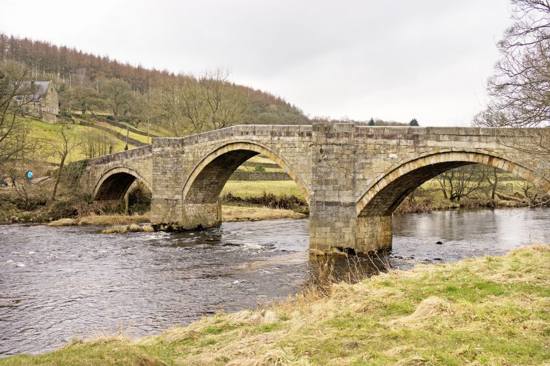
Entry Name: Barden Bridge
Listing Date: 10 September 1954
Grade: II
Source: Historic England
Source ID: 1131759
English Heritage Legacy ID: 323682
ID on this website: 101131759
Location: North Yorkshire, BD23
County: North Yorkshire
District: Craven
Civil Parish: Barden
Traditional County: Yorkshire
Lieutenancy Area (Ceremonial County): North Yorkshire
Tagged with: Bridge Road bridge
BARDEN APPLETREEWICK ROAD
SE 05 NE
6/29 Barden Bridge
10.9.54
II
Bridge. 1659 (Pevsner). Ashlar. 3 large segmental arches with voussoirs
and hoodmoulds. Triangular-section cutwaters rise into pedestrian retreats.
Parapet inscription on the north parapet at the east end, "this bridge was
repayred at the charge of the the whole West riding 167b". Also a scheduled
ancient monument (Yorkshire West Riding) No 71.
Listing NGR: SE0521857404
External links are from the relevant listing authority and, where applicable, Wikidata. Wikidata IDs may be related buildings as well as this specific building. If you want to add or update a link, you will need to do so by editing the Wikidata entry.


Other nearby listed buildings
