Approximate Location Map
Large Map »
Latitude: 54.2071 / 54°12'25"N
Longitude: -2.1477 / 2°8'51"W
OS Eastings: 390460
OS Northings: 479048
OS Grid: SD904790
Mapcode National: GBR FMFS.TM
Mapcode Global: WHB60.ZJF4
Plus Code: 9C6V6V42+RW
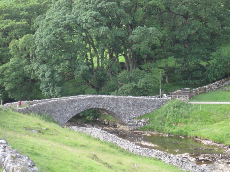
Entry Name: The Bridge
Listing Date: 10 September 1954
Grade: II
Source: Historic England
Source ID: 1132216
English Heritage Legacy ID: 324637
ID on this website: 101132216
Location: Yockenthwaite, North Yorkshire, BD23
County: North Yorkshire
District: Craven
Civil Parish: Buckden
Traditional County: Yorkshire
Lieutenancy Area (Ceremonial County): North Yorkshire
Tagged with: Bridge Packhorse bridge
SD 97 NW BUCKDEN YOCKENTHWAITE
6/50 The Bridge
10.8.54
GV II
Bridge over River Wharfe. Probably early C18. Gritstone rubble. A single
high segmental arch with roughly shaped voussoirs, narrow roadway over, and
rounded parapet coping. Some rebuilding to parapet wall.
Listing NGR: SD9046079048
External links are from the relevant listing authority and, where applicable, Wikidata. Wikidata IDs may be related buildings as well as this specific building. If you want to add or update a link, you will need to do so by editing the Wikidata entry.


Other nearby listed buildings
