Approximate Location Map
Large Map »
Latitude: 54.2077 / 54°12'27"N
Longitude: -2.146 / 2°8'45"W
OS Eastings: 390572
OS Northings: 479119
OS Grid: SD905791
Mapcode National: GBR FMGS.5D
Mapcode Global: WHB61.0HCM
Plus Code: 9C6V6V53+3H
Entry Name: Top Farmhouse
Listing Date: 4 May 1989
Grade: II
Source: Historic England
Source ID: 1316799
English Heritage Legacy ID: 324639
ID on this website: 101316799
Location: Yockenthwaite, North Yorkshire, BD23
County: North Yorkshire
District: Craven
Civil Parish: Buckden
Traditional County: Yorkshire
Lieutenancy Area (Ceremonial County): North Yorkshire
Tagged with: Farmhouse
SD 97 NW
6/52
BUCKDEN
YOCKENTHWAITE
Top Farmhouse
GV
II
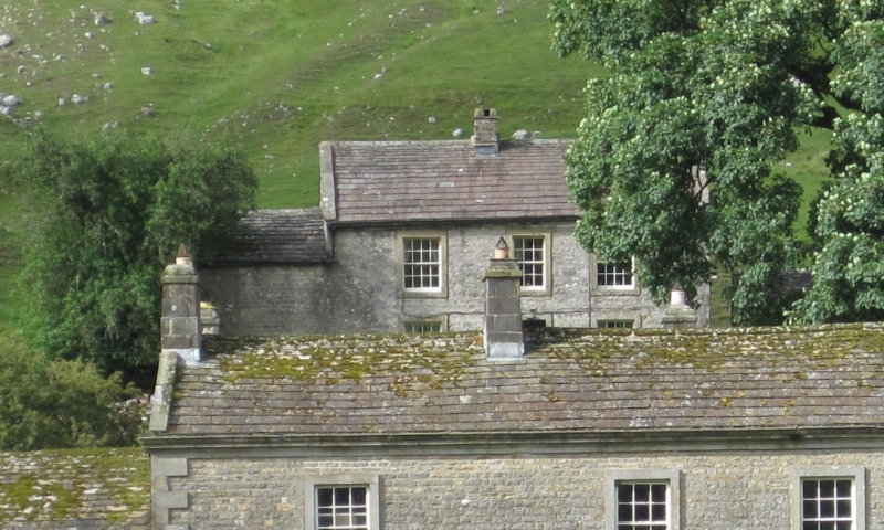
House. Early C19. Coursed squared gritstone, graduated stone slate roof.
2 storeys, 3 bays, with lower bay to left. Quoins. Central glazed door
with overlight in plain stone surround. End stack right and ridge stack to
left of door. Lower bay left, now a garage, has a small inserted window.
Included for group value.
Listing NGR: SD9057279119
External links are from the relevant listing authority and, where applicable, Wikidata. Wikidata IDs may be related buildings as well as this specific building. If you want to add or update a link, you will need to do so by editing the Wikidata entry.


Other nearby listed buildings
