Latitude: 53.8324 / 53°49'56"N
Longitude: -1.1294 / 1°7'45"W
OS Eastings: 457394
OS Northings: 437699
OS Grid: SE573376
Mapcode National: GBR NSK3.8Y
Mapcode Global: WHDBJ.MXDW
Plus Code: 9C5WRVJC+X6
Entry Name: Gatehouse
Listing Date: 17 November 1966
Last Amended: 5 November 1984
Grade: I
Source: Historic England
Source ID: 1132508
English Heritage Legacy ID: 325885
ID on this website: 101132508
Location: Cawood, North Yorkshire, YO8
County: North Yorkshire
District: Selby
Civil Parish: Cawood
Built-Up Area: Cawood
Traditional County: Yorkshire
Lieutenancy Area (Ceremonial County): North Yorkshire
Church of England Parish: Cawood All Saints
Church of England Diocese: York
Tagged with: Gatehouse
SE 5737 CAWOOD THORPE LANE (west side)
9/24 Gatehouse (formerly listed with No 2 Thorpe Lane (qv) 17.11.66 and the Banqueting Hall (qv) as Cawood Castle)
GV I
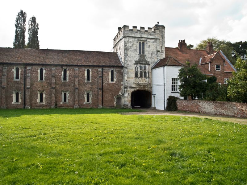
Gatehouse. c 1426-51. For Archbishop Kempe. Magnesian limestone ashlar with stone slate roof to oriel windows otherwise roof concealed by parapet. 3 storeys, 1 bay. North front: full freight, narrow angle buttressing with set-offs. Carriage arch with enriched spandrels and drip mould encroached on to right by 2 Thorpe Lane (qv). Canted oriel window to first floor with heraldic shields to panelled base. Traceried windows with leaded lights. Roof has ornamental cresting. Blocked 2-light flat-arched window to second floor under drip mould. Coved cornice and parapet. Original stair turret with slit windows projects above main roof level. Rear: 4-centred pedestrian archway to left and 4-centred carriage archway to right, both contained under large segmental arch with cornice. First floor band with heraldic shields and capping. Centre 3 shields project slightly to support oriel window of 3 traceried lights, with 4-centred head. Ornamental cresting to roof. To second floor: 2-light window with small leaded panes and traceried heads under drip mould. Angle buttresses with set-offs rise from heraldic band to support coving and parapet. Octagonal stone chimneys to each side. Interior: carriageway has tierceron vaulting. 4-centred doorway to stairs. One original oak door is lying on its side in carriageway. Upper floors not inspected. Pevsner, N., North Yorkshire, The West Riding, 1979, p 160. 'North Yorkshire County Council, County Planning Department, Historical Account'.
Listing NGR: SE5739437699
External links are from the relevant listing authority and, where applicable, Wikidata. Wikidata IDs may be related buildings as well as this specific building. If you want to add or update a link, you will need to do so by editing the Wikidata entry.


Other nearby listed buildings