Latitude: 53.8323 / 53°49'56"N
Longitude: -1.1292 / 1°7'45"W
OS Eastings: 457408
OS Northings: 437687
OS Grid: SE574376
Mapcode National: GBR NSK3.BZ
Mapcode Global: WHDBJ.MXHZ
Plus Code: 9C5WRVJC+W8
Entry Name: Banqueting Hall Adjoining East Side of Gatehouse
Listing Date: 17 November 1966
Last Amended: 5 November 1984
Grade: I
Source: Historic England
Source ID: 1174558
English Heritage Legacy ID: 325886
Also known as: Cawood Castle and Castle Garth: residence of the medieval Archbishops of York and associated enclosure containing gardens, five
ID on this website: 101174558
Location: Cawood, North Yorkshire, YO8
County: North Yorkshire
District: Selby
Civil Parish: Cawood
Built-Up Area: Cawood
Traditional County: Yorkshire
Lieutenancy Area (Ceremonial County): North Yorkshire
Church of England Parish: Cawood All Saints
Church of England Diocese: York
Tagged with: Quadrangular castle
SE 5737 CAWOOD THORPE LANE (west side)
9/25 Banqueting Hall adjoining east side of Gatehouse (qv) 17.11.66 (formerly listed with Gatehouse and No 2 Thorpe Lane (qv) as Cawood Castle)
GV I
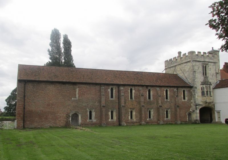
Banqueting hall. cl426/51 with later rebuilding to upper part of south side. Dark pink brick with magnesian limestone dressings to original openings and swept pantile roof. Upper-floor hall. 2 storeys, 8 bays. North front: partly obscured by later structures. From left, bays 3 to 7 visible: 4-centred doorway and blocked single cusped light, flat-arched window under drip mould; remains of similar blocked window; later cart entrance; a further original window and later blocked round-arched entrance; blocked original window. Each bay articulated by buttresses with set-offs rising through one and a half storeys. To first floor similar blocked window to each bay. To rear (south) blind ground floor with later openings to first and seventh bays and cart entrance to fourth bay. Ground floor projects slightly and has moulded brick and magnesian limestone band at first floor level. Each bay articulated by buttresses with set-offs, that to fifth bay removed to make way for later addition, now demolished. First floor: bays 1 to 6 have blocked original windows under continuous drip mould. Windows to fourth and fifth bays have iron glazing bars. Roof pitch made less steep. Interior: originally floored, now open to roof. Blocked first floor doorway to west end, first floor fireplace at south-east corner. Arch brace collar and tie beam roof with 2 levels of purlins. 'North Yorkshire County Council, County Planning Department, Historical Account'.
Listing NGR: SE5740937687
External links are from the relevant listing authority and, where applicable, Wikidata. Wikidata IDs may be related buildings as well as this specific building. If you want to add or update a link, you will need to do so by editing the Wikidata entry.


Other nearby listed buildings