Latitude: 53.3549 / 53°21'17"N
Longitude: -1.2216 / 1°13'17"W
OS Eastings: 451908
OS Northings: 384509
OS Grid: SK519845
Mapcode National: GBR MYXN.B2
Mapcode Global: WHDDT.6XKX
Plus Code: 9C5W9Q3H+X9
Entry Name: 7, Hillside
Listing Date: 15 October 1986
Grade: II
Source: Historic England
Source ID: 1132682
English Heritage Legacy ID: 335815
ID on this website: 101132682
Location: North Anston, Rotherham, South Yorkshire, S25
County: Rotherham
Civil Parish: North and South Anston
Built-Up Area: Dinnington
Traditional County: Yorkshire
Lieutenancy Area (Ceremonial County): South Yorkshire
Church of England Parish: Anston St James
Church of England Diocese: Sheffield
Tagged with: Building
NORTH AND SOUTH ANSTON HILLSIDE SK58SW (south side), North Anston 5/65 No 7
II
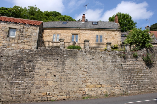
House. Early C18. Roughcast limestone, Welsh slate roof. 2 storeys with attic, 3 bays. Chamfered ashlar quoins. Central doorway has bolection-moulded surround with consoles to broken segmental pediment, flanking windows have architraves, that to bay 1 with 4-pane sash that to bay 3 with C20 casement flanked by inserted doorways. 1st-floor band beneath 3 windows, bay as below bays 2 and 3 with central mullions and casements. Eaves cornice; shaped kneelers and gable copings on right. Brick end stack, matching ridge stack to right of door. Right return: brick lean-to (not of special interest); 2 attic windows with architraves as front. Interior: bolection-moulded fireplace to 1st-floor room on right, small fielded- panel wall cupboard on its right. Fireplace to other 1st-floor room has eared wooden architrave.
Listing NGR: SK5190884508
External links are from the relevant listing authority and, where applicable, Wikidata. Wikidata IDs may be related buildings as well as this specific building. If you want to add or update a link, you will need to do so by editing the Wikidata entry.


Other nearby listed buildings