Latitude: 53.4675 / 53°28'2"N
Longitude: -1.2884 / 1°17'18"W
OS Eastings: 447339
OS Northings: 396983
OS Grid: SK473969
Mapcode National: GBR MXFB.WQ
Mapcode Global: WHDDD.53RL
Plus Code: 9C5WFP86+XM
Entry Name: Hooton Common Farmhouse
Listing Date: 21 August 1985
Grade: II
Source: Historic England
Source ID: 1132815
English Heritage Legacy ID: 335519
ID on this website: 101132815
Location: Hooton Roberts, Rotherham, South Yorkshire, S65
County: Rotherham
Civil Parish: Hooton Roberts
Traditional County: Yorkshire
Lieutenancy Area (Ceremonial County): South Yorkshire
Church of England Parish: Hooton Roberts St John
Church of England Diocese: Sheffield
Tagged with: Farmhouse
SOUTH YORKSHIRE ROTHERHAM 5097 SK49NE HOOTON ROBERTS (CARR LANE) (west side)
6/10 Hooton Common Farmhouse
II
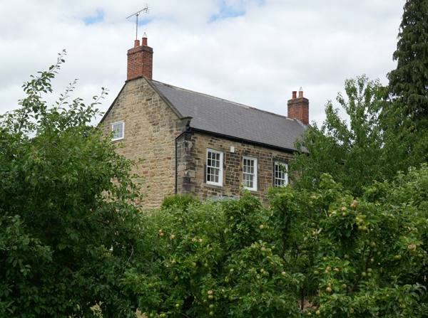
Farmhouse. Mid C18. Coursed, squared sandstone; Welsh slate roof with stone slates to part of rear; renewed brick stacks. 2 storeys and attic, 5-bay front with wing to rear right. Projecting ashlar quoins. Central panelled door in stone architrave flanked by C20, canted, bay-windows. 1st floor: sashes with glazing bars in projecting square-faced surrounds. Shaped kneelers, chamfered gable copings. End stacks. Right return: 2-light, square-faced mullion windows; upper window part-blocked. Disused and semi-derelict section of rear wing not of special interest.
Listing NGR: SK4733996983
External links are from the relevant listing authority and, where applicable, Wikidata. Wikidata IDs may be related buildings as well as this specific building. If you want to add or update a link, you will need to do so by editing the Wikidata entry.


Other nearby listed buildings