Latitude: 53.6729 / 53°40'22"N
Longitude: -1.878 / 1°52'40"W
OS Eastings: 408159
OS Northings: 419608
OS Grid: SE081196
Mapcode National: GBR HTBZ.73
Mapcode Global: WHC9T.4Y05
Plus Code: 9C5WM4FC+5R
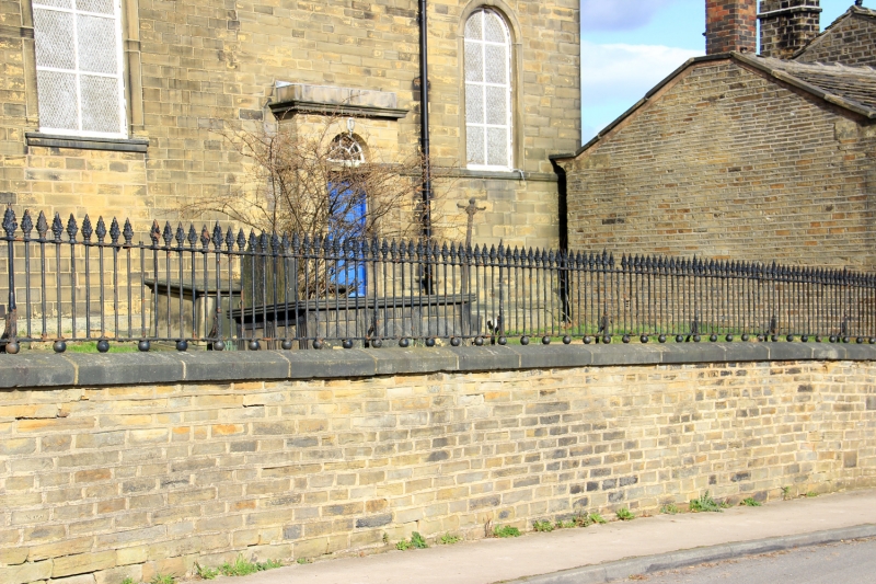
Entry Name: Graveyard Wall and Railings at Church of St Andrew
Listing Date: 29 April 1982
Grade: II
Source: Historic England
Source ID: 1133963
English Heritage Legacy ID: 338547
ID on this website: 101133963
Location: St Andrew's Church, Stainland, Calderdale, West Yorkshire, HX4
County: Calderdale
Electoral Ward/Division: Greetland and Stainland
Parish: Stainland and District
Built-Up Area: Holywell Green
Traditional County: Yorkshire
Lieutenancy Area (Ceremonial County): West Yorkshire
Church of England Parish: Stainland
Church of England Diocese: Leeds
Tagged with: Wall
ELLAND STAINLAND ROAD SE 081196 (west side) 6/123 Graveyard Wall and Railings of the Church of St. Andrew 29.4.82 G.V. II
c1740-50 cast iron floral head rails on coursed stone coped wall along roadside and returned to east wing and tower porch on lane.
Listing NGR: SE0815919608
External links are from the relevant listing authority and, where applicable, Wikidata. Wikidata IDs may be related buildings as well as this specific building. If you want to add or update a link, you will need to do so by editing the Wikidata entry.


Other nearby listed buildings