Latitude: 53.6512 / 53°39'4"N
Longitude: -1.8432 / 1°50'35"W
OS Eastings: 410463
OS Northings: 417200
OS Grid: SE104172
Mapcode National: GBR HVK6.RW
Mapcode Global: WHCB0.NHH8
Plus Code: 9C5WM524+FP
Entry Name: 14, Greenhill Road
Listing Date: 29 September 1978
Grade: II
Source: Historic England
Source ID: 1134211
English Heritage Legacy ID: 339916
ID on this website: 101134211
Location: Salendine Nook, Kirklees, West Yorkshire, HD3
County: Kirklees
Electoral Ward/Division: Golcar
Parish: Non Civil Parish
Built-Up Area: Huddersfield
Traditional County: Yorkshire
Lieutenancy Area (Ceremonial County): West Yorkshire
Church of England Parish: Longwood St Mark the Evangelist
Church of England Diocese: Leeds
Tagged with: Building
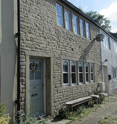
GREENHILL ROAD
1.
5113
(North Side)
No 14
SE 1017 26/589
II GV
2.
Early C19. Rendered. Pitched stone slate roof. 2 storeys. One range of
5-light stone mullioned windows with segment-headed frames.
Listing NGR: SE1046317200
External links are from the relevant listing authority and, where applicable, Wikidata. Wikidata IDs may be related buildings as well as this specific building. If you want to add or update a link, you will need to do so by editing the Wikidata entry.


Other nearby listed buildings