Approximate Location Map
Large Map »
Latitude: 53.6478 / 53°38'52"N
Longitude: -1.7543 / 1°45'15"W
OS Eastings: 416336
OS Northings: 416842
OS Grid: SE163168
Mapcode National: GBR JV58.Z2
Mapcode Global: WHCB2.0KWV
Plus Code: 9C5WJ6XW+47
Entry Name: Standiforth Cottage
Listing Date: 29 September 1978
Grade: II
Source: Historic England
Source ID: 1134285
English Heritage Legacy ID: 339794
ID on this website: 101134285
Location: Grove Place, Kirklees, West Yorkshire, HD5
County: Kirklees
Electoral Ward/Division: Dalton
Parish: Non Civil Parish
Built-Up Area: Huddersfield
Traditional County: Yorkshire
Lieutenancy Area (Ceremonial County): West Yorkshire
Church of England Parish: Kirkheaton St John the Baptist
Church of England Diocese: Leeds
Tagged with: Cottage
DYSON STREET
1.
5113
Dalton
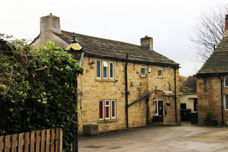
No 72 (Standiforth Cottage)
SE 1616 35/464
II
2.
C18 or C19. Hammer-dressed stone. Pitched and slurried stone slate roof.
2 storeys. One 3-light stone mullioned window on each side, with intermediate
openings blocked.
Listing NGR: SE1633616842
External links are from the relevant listing authority and, where applicable, Wikidata. Wikidata IDs may be related buildings as well as this specific building. If you want to add or update a link, you will need to do so by editing the Wikidata entry.


Other nearby listed buildings
