Approximate Location Map
Large Map »
Latitude: 53.646 / 53°38'45"N
Longitude: -1.7808 / 1°46'50"W
OS Eastings: 414586
OS Northings: 416628
OS Grid: SE145166
Mapcode National: GBR JV08.8R
Mapcode Global: WHCB1.MM69
Plus Code: 9C5WJ6W9+9M
Entry Name: 29, Cross Church Street
Listing Date: 29 September 1978
Grade: II
Source: Historic England
Source ID: 1134310
English Heritage Legacy ID: 339756
ID on this website: 101134310
Location: Huddersfield, Kirklees, West Yorkshire, HD1
County: Kirklees
Electoral Ward/Division: Newsome
Parish: Non Civil Parish
Built-Up Area: Huddersfield
Traditional County: Yorkshire
Lieutenancy Area (Ceremonial County): West Yorkshire
Church of England Parish: Huddersfield St Peter
Church of England Diocese: Leeds
Tagged with: Building
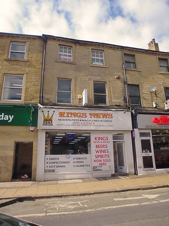
CROSS CHURCH STREET
1.
5113
(West Side)
No 29
SE 1416 NE 2/425
II GV
2.
Early C19. Hammer-dressed stone. Pitched stone slate roof. 3 storeys. Modillion
eaves cornice. 2 ranges of sashes with glazing bars. Modern shop.
Listing NGR: SE1458616628
External links are from the relevant listing authority and, where applicable, Wikidata. Wikidata IDs may be related buildings as well as this specific building. If you want to add or update a link, you will need to do so by editing the Wikidata entry.


Other nearby listed buildings
