Latitude: 53.6458 / 53°38'44"N
Longitude: -1.7808 / 1°46'50"W
OS Eastings: 414590
OS Northings: 416612
OS Grid: SE145166
Mapcode National: GBR JV08.8T
Mapcode Global: WHCB1.MM7D
Plus Code: 9C5WJ6W9+8M
Entry Name: Burns Tavern
Listing Date: 29 September 1978
Grade: II
Source: Historic England
Source ID: 1135002
English Heritage Legacy ID: 340045
ID on this website: 101135002
Location: Huddersfield, Kirklees, West Yorkshire, HD1
County: Kirklees
Electoral Ward/Division: Newsome
Parish: Non Civil Parish
Built-Up Area: Huddersfield
Traditional County: Yorkshire
Lieutenancy Area (Ceremonial County): West Yorkshire
Church of England Parish: Huddersfield St Peter
Church of England Diocese: Leeds
Tagged with: Pub
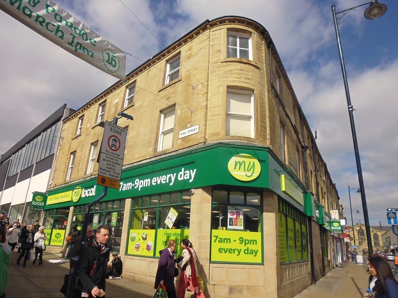
KING STREET 1. 5113 (North Side) No 35 (Burns Tavern) and No 37 SE 1614 NE 2/716 II GV 2. Early C19. Ashlar. Hipped stone slate roof. 3 storeys. Stone brackets to gutter. Continuous sill band to 1st floor. Carved corner to Cross Church Street. 5 ranges of sashes in plain raised surrounds to King Street, one range on the corner, 2 to Cross Church Street. No 35 has good late C19 public house front, with moulded ashlar base and 5 plate glass windows with 3-centred heads and leaf spandrels: 2 doors with ornate moulded panelling and fanlights: fascia flanked by console-shaped scrolls. No 37 has mid C20 shopfront.
Listing NGR: SE1201317604
External links are from the relevant listing authority and, where applicable, Wikidata. Wikidata IDs may be related buildings as well as this specific building. If you want to add or update a link, you will need to do so by editing the Wikidata entry.


Other nearby listed buildings