Approximate Location Map
Large Map »
Latitude: 53.6653 / 53°39'55"N
Longitude: -1.8211 / 1°49'15"W
OS Eastings: 411920
OS Northings: 418775
OS Grid: SE119187
Mapcode National: GBR HVQ1.JT
Mapcode Global: WHCB1.043F
Plus Code: 9C5WM58H+4H
Entry Name: 13, Burn Road
Listing Date: 2 June 1976
Grade: II
Source: Historic England
Source ID: 1134340
English Heritage Legacy ID: 339625
ID on this website: 101134340
Location: Birchencliffe, Kirklees, West Yorkshire, HD3
County: Kirklees
Electoral Ward/Division: Lindley
Parish: Non Civil Parish
Built-Up Area: Huddersfield
Traditional County: Yorkshire
Lieutenancy Area (Ceremonial County): West Yorkshire
Church of England Parish: Birchencliffe St Philip the Apostle
Church of England Diocese: Leeds
Tagged with: Building
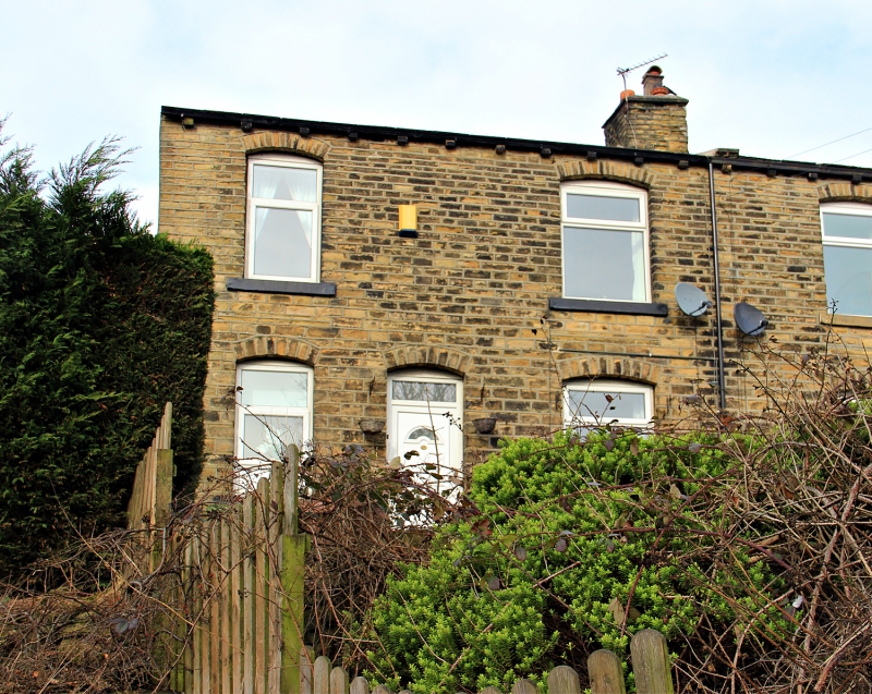
BURN ROAD
1.
5113
(South Side)
Birchencliffe
No 13
SE 1118 20/79 2.6.76.
II GV
2.
C18 or early C19. Hammer dressed stone. Pitched stone slate roof. 2 storeys.
One 3-light and one 2-light stone mullioned sash on lst floor. One 4-light
stone mullioned sash on ground floor.
Listing NGR: SE1192018775
External links are from the relevant listing authority and, where applicable, Wikidata. Wikidata IDs may be related buildings as well as this specific building. If you want to add or update a link, you will need to do so by editing the Wikidata entry.


Other nearby listed buildings
