Approximate Location Map
Large Map »
Latitude: 53.5954 / 53°35'43"N
Longitude: -1.7733 / 1°46'23"W
OS Eastings: 415099
OS Northings: 410999
OS Grid: SE150109
Mapcode National: GBR JV1V.WW
Mapcode Global: WHCB7.QWRM
Plus Code: 9C5WH6WG+4M
Entry Name: 4.5 Mile Post Opposite Junction of Brockholes Lane
Listing Date: 4 August 1983
Grade: II
Source: Historic England
Source ID: 1134831
English Heritage Legacy ID: 340448
ID on this website: 101134831
Location: Brockholes, Kirklees, West Yorkshire, HD9
County: Kirklees
Civil Parish: Holme Valley
Built-Up Area: Holmfirth
Traditional County: Yorkshire
Lieutenancy Area (Ceremonial County): West Yorkshire
Church of England Parish: Honley St Mary
Church of England Diocese: Leeds
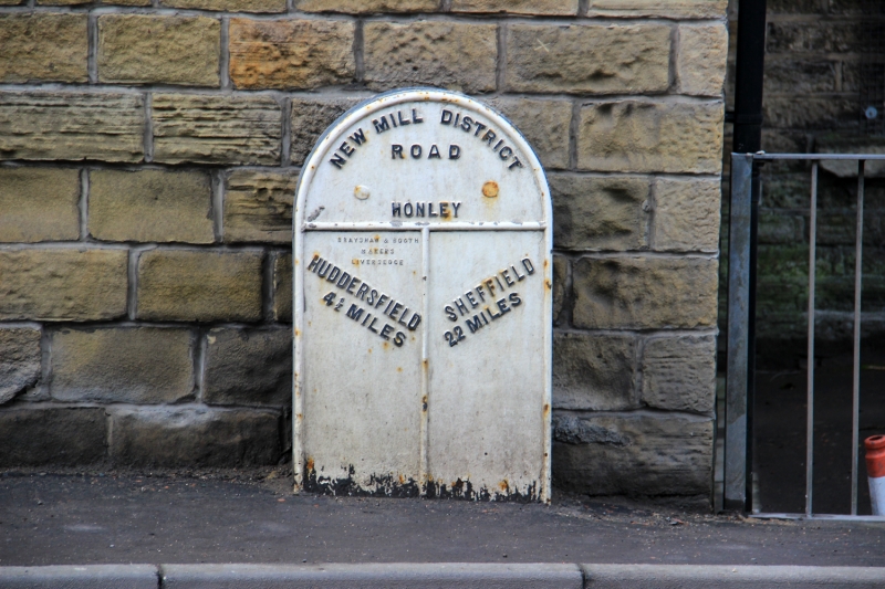
SE 11 SE NEW MILL ROAD
2/221 (Brockholes)
4½ Miles Post
Opposite Junction of
Brockholes Lane
II
Mile post. Mid-late C19. Flat cast iron front with round top. Reads:
NEW MILL DISTRICT
ROAD
HONLEY
HUDDERSFIELD SHEFFIELD
4½ MILES 22 MILES
Listing NGR: SE1509910999
External links are from the relevant listing authority and, where applicable, Wikidata. Wikidata IDs may be related buildings as well as this specific building. If you want to add or update a link, you will need to do so by editing the Wikidata entry.


Other nearby listed buildings
