Approximate Location Map
Large Map »
Latitude: 53.5965 / 53°35'47"N
Longitude: -1.7746 / 1°46'28"W
OS Eastings: 415012
OS Northings: 411125
OS Grid: SE150111
Mapcode National: GBR JV1V.LH
Mapcode Global: WHCB7.QV4Q
Plus Code: 9C5WH6WG+H4
Entry Name: Bridge over River Holme at Smithy Place
Listing Date: 4 August 1983
Grade: II
Source: Historic England
Source ID: 1228482
English Heritage Legacy ID: 340520
ID on this website: 101228482
Location: Brockholes, Kirklees, West Yorkshire, HD9
County: Kirklees
Civil Parish: Holme Valley
Built-Up Area: Holmfirth
Traditional County: Yorkshire
Lieutenancy Area (Ceremonial County): West Yorkshire
Church of England Parish: Honley St Mary
Church of England Diocese: Leeds
Tagged with: Bridge
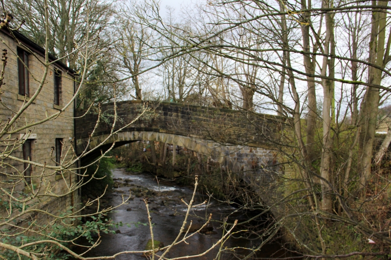
SE 11 SE SMITHY PLACE LANE
2/293 (Brockholes)
Bridge over River Holme
at Smithy Place
II
Single span segmental arched bridge. Late C18 to early C19. Coursed, dressed rubble with dressed voussoirs. String course at base of parapet. Large rounded copings.
Listing NGR: SE1501211124
External links are from the relevant listing authority and, where applicable, Wikidata. Wikidata IDs may be related buildings as well as this specific building. If you want to add or update a link, you will need to do so by editing the Wikidata entry.


Other nearby listed buildings
