Approximate Location Map
Large Map »
Latitude: 53.5788 / 53°34'43"N
Longitude: -1.7715 / 1°46'17"W
OS Eastings: 415224
OS Northings: 409155
OS Grid: SE152091
Mapcode National: GBR JW21.8V
Mapcode Global: WHCBF.R9LS
Plus Code: 9C5WH6HH+G9
Entry Name: 92, Lower Town End Road
Listing Date: 4 August 1983
Grade: II
Source: Historic England
Source ID: 1134862
English Heritage Legacy ID: 340416
ID on this website: 101134862
Location: Town End, Kirklees, West Yorkshire, HD9
County: Kirklees
Civil Parish: Holme Valley
Built-Up Area: Holmfirth
Traditional County: Yorkshire
Lieutenancy Area (Ceremonial County): West Yorkshire
Church of England Parish: New Mill Christ Church
Church of England Diocese: Leeds
Tagged with: Building
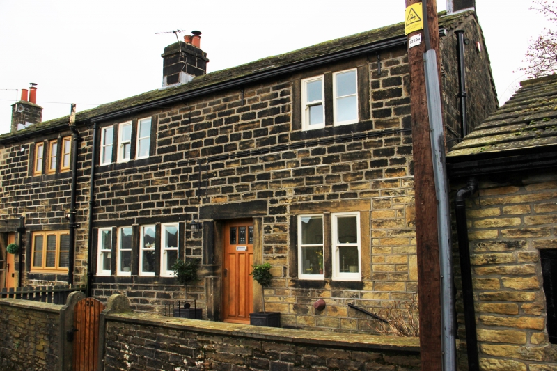
SE 10 NE LOWER TOWN END ROAD
5/189 (Wooldale)
No 92
II
Part of group. Late C18. Hammer dressed stone. Quoins. Stone slate roof. Two
storeys. Near central doorway, one 4-light and one 2-light stone mullioned windows.
First floor: one 3-light and one 2-light stone mullioned windows.
Listing NGR: SE1522409155
External links are from the relevant listing authority and, where applicable, Wikidata. Wikidata IDs may be related buildings as well as this specific building. If you want to add or update a link, you will need to do so by editing the Wikidata entry.


Other nearby listed buildings
