Approximate Location Map
Large Map »
Latitude: 53.5784 / 53°34'42"N
Longitude: -1.7737 / 1°46'25"W
OS Eastings: 415082
OS Northings: 409117
OS Grid: SE150091
Mapcode National: GBR JW11.SY
Mapcode Global: WHCBF.QBL1
Plus Code: 9C5WH6HG+9G
Entry Name: 68, Town End Road
Listing Date: 4 August 1983
Grade: II
Source: Historic England
Source ID: 1279391
English Heritage Legacy ID: 340562
ID on this website: 101279391
Location: Town End, Kirklees, West Yorkshire, HD9
County: Kirklees
Civil Parish: Holme Valley
Built-Up Area: Holmfirth
Traditional County: Yorkshire
Lieutenancy Area (Ceremonial County): West Yorkshire
Church of England Parish: New Mill Christ Church
Church of England Diocese: Leeds
Tagged with: Building
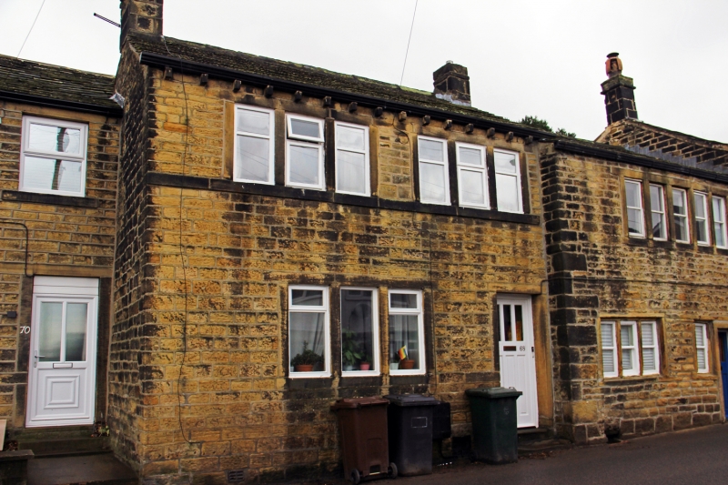
SE 10 NE TOWN END ROAD
5/334 (Town End,
Wooldale)
No 68
GV
II
Part of terrace. Mid C19. Hammer dressed stone. Stone slate roof. Stone brackets.
Two storeys. One 3-light window and entrance to ground floor. Two 3-light windows to
first floor.
Listing NGR: SE1508209117
External links are from the relevant listing authority and, where applicable, Wikidata. Wikidata IDs may be related buildings as well as this specific building. If you want to add or update a link, you will need to do so by editing the Wikidata entry.


Other nearby listed buildings
