Approximate Location Map
Large Map »
Latitude: 53.6223 / 53°37'20"N
Longitude: -1.7689 / 1°46'8"W
OS Eastings: 415381
OS Northings: 414003
OS Grid: SE153140
Mapcode National: GBR JV2K.T6
Mapcode Global: WHCB7.S6VW
Plus Code: 9C5WJ6CJ+WC
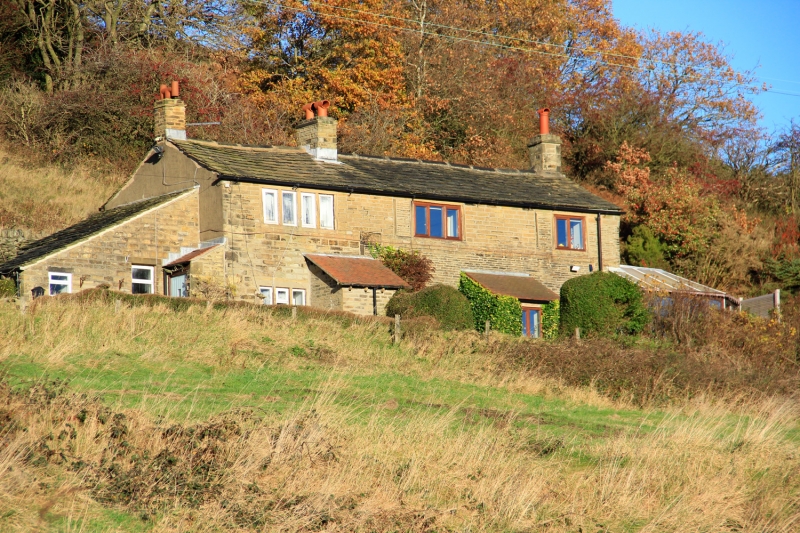
Entry Name: Castle Hill Side
Listing Date: 29 September 1978
Grade: II
Source: Historic England
Source ID: 1134945
English Heritage Legacy ID: 340201
ID on this website: 101134945
Location: The Lumb, Kirklees, West Yorkshire, HD4
County: Kirklees
Electoral Ward/Division: Almondbury
Parish: Non Civil Parish
Traditional County: Yorkshire
Lieutenancy Area (Ceremonial County): West Yorkshire
Church of England Parish: Almondbury with Farnley Tyas Team Parish
Church of England Diocese: Leeds
Tagged with: Architectural structure
LUMB LANE
1.
5113
(North Side)
Almondbury
Castle Hill Side
SE 1514 44/877
SE 1513 48/877
II
2.
C18 or C19. Hammer-dressed stone. Pitched stone slate roof. 2 storeys.
One 4-light stone mullioned window on 1st floor. One 3-light stone mullioned
window on ground floor. Various other casements and sashes.
Listing NGR: SE1538114003
External links are from the relevant listing authority and, where applicable, Wikidata. Wikidata IDs may be related buildings as well as this specific building. If you want to add or update a link, you will need to do so by editing the Wikidata entry.


Other nearby listed buildings
