Latitude: 53.9053 / 53°54'19"N
Longitude: -1.6938 / 1°41'37"W
OS Eastings: 420212
OS Northings: 445507
OS Grid: SE202455
Mapcode National: GBR JRM8.2S
Mapcode Global: WHC8X.Y3LF
Plus Code: 9C5WW844+4F
Entry Name: 36, Market Place
Listing Date: 8 July 1974
Grade: II
Source: Historic England
Source ID: 1135215
English Heritage Legacy ID: 341479
ID on this website: 101135215
Location: Otley, Leeds, West Yorkshire, LS21
County: Leeds
Civil Parish: Otley
Built-Up Area: Otley
Traditional County: Yorkshire
Lieutenancy Area (Ceremonial County): West Yorkshire
Church of England Parish: Otley All Saints
Church of England Diocese: Leeds
Tagged with: Building
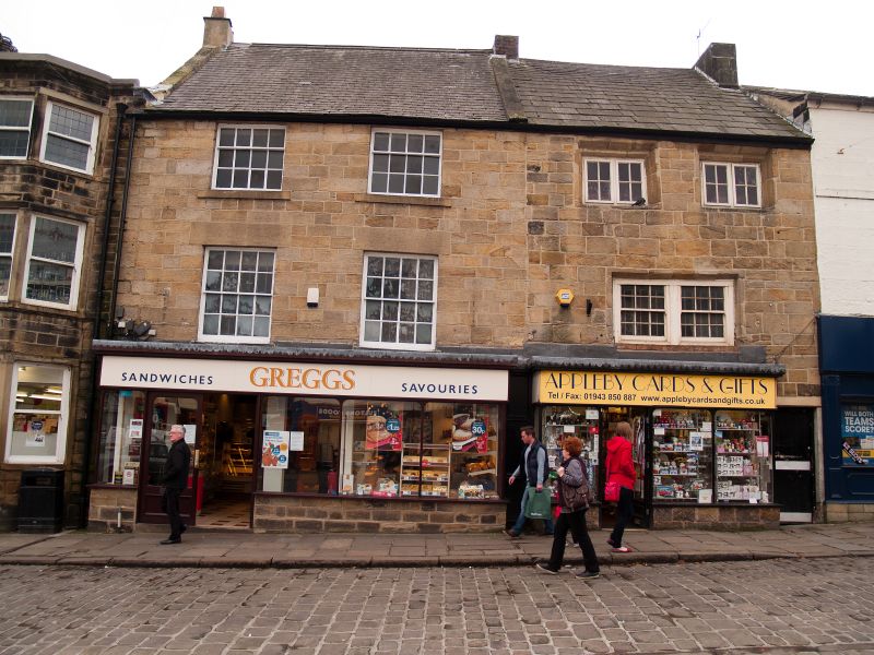
Market Place
1.
1480
(South Side)
No 36
SE 2045 1/216
II GV
2.
One occupancy with No 38. C18. Three storeys in stone, painted. Welsh
slate roof. Two windows on two storeys, hung sashes with glazing bars.
Modern shop front.
Nos 30 to 40 (even) form a group with Nos 22 and 24 and with Leeds House
Cafe, Butter Cross and Jubilee Clock.
Listing NGR: SE2021245507
External links are from the relevant listing authority and, where applicable, Wikidata. Wikidata IDs may be related buildings as well as this specific building. If you want to add or update a link, you will need to do so by editing the Wikidata entry.


Other nearby listed buildings