Latitude: 53.5917 / 53°35'30"N
Longitude: -1.652 / 1°39'7"W
OS Eastings: 423128
OS Northings: 410630
OS Grid: SE231106
Mapcode National: GBR JVXX.45
Mapcode Global: WHCB9.LZJC
Plus Code: 9C5WH8RX+M5
Entry Name: 5, Commercial Road
Listing Date: 15 August 1985
Grade: II
Source: Historic England
Source ID: 1135294
English Heritage Legacy ID: 341293
ID on this website: 101135294
Location: Skelmanthorpe, Kirklees, West Yorkshire, HD8
County: Kirklees
Civil Parish: Denby Dale
Built-Up Area: Skelmanthorpe
Traditional County: Yorkshire
Lieutenancy Area (Ceremonial County): West Yorkshire
Church of England Parish: Skelmanthorpe St Aidan
Church of England Diocese: Leeds
Tagged with: Building
SE 21 SW COMMERCIAL ROAD Skelmanthorpe 1/26 No. 5
II
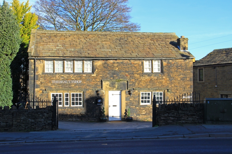
Detached house. Dated 1642. Dry coursed rubble. Quoins. Stone slate roof (renewed) with hollow chamfered coping to left gable. Two storeys. Near-central doorway with square jambs and big lintel inscribed 1642 T.I. Windows are double chamfered. One 5-light to left and one 4-light to right, both with 2 mullions removed. These both have hood mould which continues up and over doorway. One 5-light and one 2-light window to 1st floor. Both gables have double chamfered windows, some blocked or altered. Continuous outshut to rear, probably of same date, with doorway and small 2-light window to each side, both with mullion removed.
Chamfered beams and stop-chamfered joists to left room.
Listing NGR: SE2312810630
External links are from the relevant listing authority and, where applicable, Wikidata. Wikidata IDs may be related buildings as well as this specific building. If you want to add or update a link, you will need to do so by editing the Wikidata entry.


Other nearby listed buildings