Approximate Location Map
Large Map »
Latitude: 53.6256 / 53°37'32"N
Longitude: -1.721 / 1°43'15"W
OS Eastings: 418546
OS Northings: 414378
OS Grid: SE185143
Mapcode National: GBR JVFJ.61
Mapcode Global: WHCB8.J4NC
Plus Code: 9C5WJ7GH+6H
Entry Name: Woodsome Bridge
Listing Date: 16 May 1984
Grade: II
Source: Historic England
Source ID: 1135320
English Heritage Legacy ID: 341259
ID on this website: 101135320
Location: Dogley Lane, Kirklees, West Yorkshire, HD8
County: Kirklees
Civil Parish: Kirkburton
Traditional County: Yorkshire
Lieutenancy Area (Ceremonial County): West Yorkshire
Church of England Parish: Lepton St John
Church of England Diocese: Leeds
Tagged with: Bridge
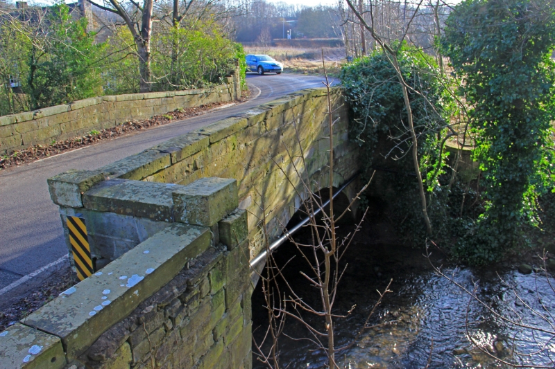
SE 11 SE WOODSOME ROAD
Fenay Bridge
5/141
Woodsome Bridge
G.V. II
Road bridge. Probably early C19. Ashlar, single-span, round arched
bridge with string course at base of parapet. Slightly rounded copings.
Listing NGR: SE1854614378
External links are from the relevant listing authority and, where applicable, Wikidata. Wikidata IDs may be related buildings as well as this specific building. If you want to add or update a link, you will need to do so by editing the Wikidata entry.


Other nearby listed buildings
