Approximate Location Map
Large Map »
Latitude: 53.6069 / 53°36'24"N
Longitude: -1.7117 / 1°42'42"W
OS Eastings: 419173
OS Northings: 412294
OS Grid: SE191122
Mapcode National: GBR JVHQ.6S
Mapcode Global: WHCB8.PL3S
Plus Code: 9C5WJ74Q+P8
Entry Name: Milestone
Listing Date: 16 May 1984
Grade: II
Source: Historic England
Source ID: 1135338
English Heritage Legacy ID: 341200
ID on this website: 101135338
Location: Causeway Foot, Kirklees, West Yorkshire, HD8
County: Kirklees
Civil Parish: Kirkburton
Traditional County: Yorkshire
Lieutenancy Area (Ceremonial County): West Yorkshire
Church of England Parish: Kirkburton All Hallows
Church of England Diocese: Leeds
Tagged with: Milestone
SE 11 SE PENISTONE ROAD
SE 1917 1229 (east side)
Kirkburton
5/85
Milestone 200 yards to
north of junction with
Riley Lane
II
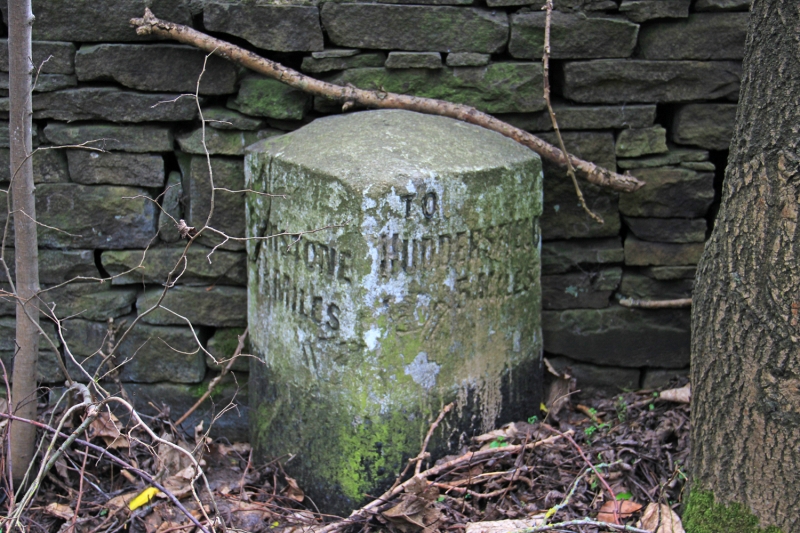
Milestone. Early to mid C19. Triangular stone post inscribed on
2 faces. TO TO
PENISTONE HUDDERSFIELD
7½ MILES 5 MILES
In each case a pointing hand indicates the direction.
Listing NGR: SE1917312294
External links are from the relevant listing authority and, where applicable, Wikidata. Wikidata IDs may be related buildings as well as this specific building. If you want to add or update a link, you will need to do so by editing the Wikidata entry.


Other nearby listed buildings
