Approximate Location Map
Large Map »
Latitude: 53.6754 / 53°40'31"N
Longitude: -1.4592 / 1°27'33"W
OS Eastings: 435821
OS Northings: 420017
OS Grid: SE358200
Mapcode National: GBR LT7Y.W6
Mapcode Global: WHDC4.KWC7
Plus Code: 9C5WMGGR+58
Entry Name: Mounting Block Approximately 20 Metres to North of Beech Lawn
Listing Date: 27 August 1986
Grade: II
Source: Historic England
Source ID: 1135547
English Heritage Legacy ID: 342382
ID on this website: 101135547
Location: Heath, Wakefield, West Yorkshire, WF1
County: Wakefield
Civil Parish: Warmfield cum Heath
Traditional County: Yorkshire
Lieutenancy Area (Ceremonial County): West Yorkshire
Church of England Parish: Warmfield St Peter
Church of England Diocese: Leeds
Tagged with: Mounting block
SE 3519 and SE 3520
6/77
WARMFIELD-CUM-HEATH
HEATH COMMON
(east side)
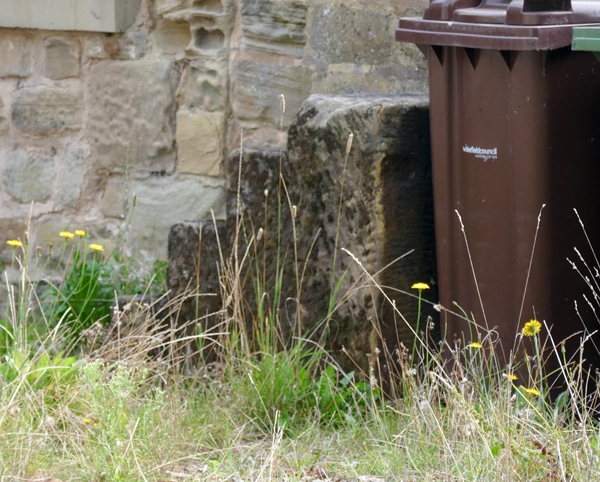
Mounting block approx. 20m to north of Beech Lawn
GV
II
Mounting block. Probably early-mid C19. Dressed freestone. A single block
with cut steps.
Included for group value.
Listing NGR: SE3582120017
External links are from the relevant listing authority and, where applicable, Wikidata. Wikidata IDs may be related buildings as well as this specific building. If you want to add or update a link, you will need to do so by editing the Wikidata entry.


Other nearby listed buildings
