Approximate Location Map
Large Map »
Latitude: 51.5384 / 51°32'18"N
Longitude: -2.3934 / 2°23'36"W
OS Eastings: 372814
OS Northings: 182234
OS Grid: ST728822
Mapcode National: GBR 0NJ.FQK
Mapcode Global: VH95T.GLLK
Plus Code: 9C3VGJQ4+8M
Entry Name: 53 and 55, Broad Street
Listing Date: 29 July 1983
Grade: II
Source: Historic England
Source ID: 1135807
English Heritage Legacy ID: 34064
ID on this website: 101135807
Location: Chipping Sodbury, South Gloucestershire, BS37
County: South Gloucestershire
Civil Parish: Sodbury
Built-Up Area: Chipping Sodbury
Traditional County: Gloucestershire
Lieutenancy Area (Ceremonial County): Gloucestershire
Church of England Parish: Chipping Sodbury St John the Baptist
Church of England Diocese: Gloucester
Tagged with: Building
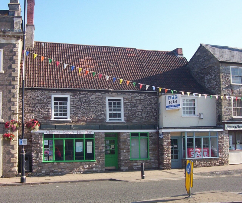
ST 7282 SE SODBURY BROAD STREET
5/17 (north side)
Nos 53 and 55
GV
II
Probably C17 but much altered. Rubble. No 55 is rendered. Double Roman tiled roof.
Upper floor, 16 pane glazing bar sashes. Modern shopfront and door.
Listing NGR: ST7281182234
External links are from the relevant listing authority and, where applicable, Wikidata. Wikidata IDs may be related buildings as well as this specific building. If you want to add or update a link, you will need to do so by editing the Wikidata entry.


Other nearby listed buildings
