Approximate Location Map
Large Map »
Latitude: 51.5381 / 51°32'17"N
Longitude: -2.3938 / 2°23'37"W
OS Eastings: 372785
OS Northings: 182205
OS Grid: ST727822
Mapcode National: GBR 0NJ.FMC
Mapcode Global: VH95T.GLCR
Plus Code: 9C3VGJQ4+6F
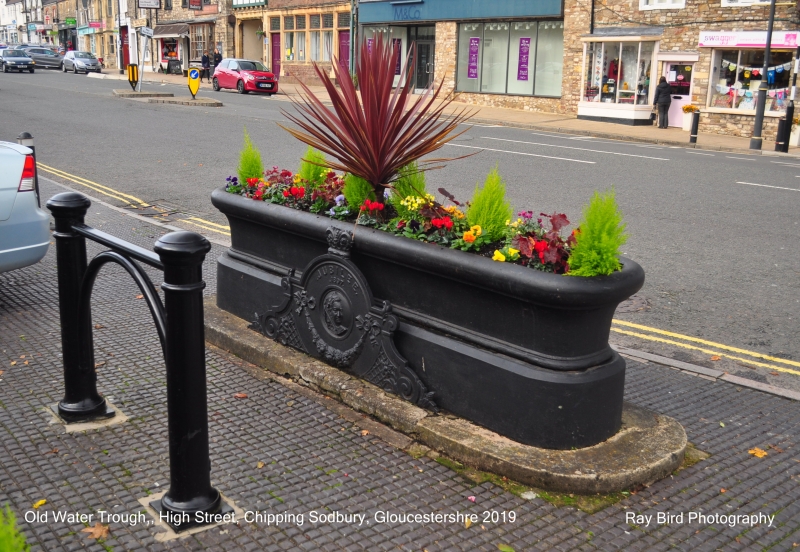
Entry Name: Horse Trough, 10 Feet in Front of Number 46
Listing Date: 29 July 1983
Grade: II
Source: Historic England
Source ID: 1320907
English Heritage Legacy ID: 34127
ID on this website: 101320907
Location: Chipping Sodbury, South Gloucestershire, BS37
County: South Gloucestershire
Civil Parish: Sodbury
Built-Up Area: Chipping Sodbury
Traditional County: Gloucestershire
Lieutenancy Area (Ceremonial County): Gloucestershire
Church of England Parish: Chipping Sodbury St John the Baptist
Church of England Diocese: Gloucester
Tagged with: Manger
ST 7282 SE SODBURY HIGH STREET
(south side)
5/80
Horse Trough, 1O ft
in front of No 46
GV
II
Dated 1897. Cast iron horse trough with decorative panels on north and south sides.
South side has inscription 'Jubilee 1897'.
Listing NGR: ST7278582205
External links are from the relevant listing authority and, where applicable, Wikidata. Wikidata IDs may be related buildings as well as this specific building. If you want to add or update a link, you will need to do so by editing the Wikidata entry.


Other nearby listed buildings
