Latitude: 51.5976 / 51°35'51"N
Longitude: -2.6127 / 2°36'45"W
OS Eastings: 357653
OS Northings: 188930
OS Grid: ST576889
Mapcode National: GBR JP.BKJC
Mapcode Global: VH881.N3LL
Plus Code: 9C3VH9XP+2W
Entry Name: Pair of Piers About 8 Metres West of Villa Farmhouse
Listing Date: 5 December 1984
Grade: II
Source: Historic England
Source ID: 1136375
English Heritage Legacy ID: 35178
ID on this website: 101136375
Location: Aust, South Gloucestershire, BS35
County: South Gloucestershire
Civil Parish: Aust
Built-Up Area: Aust
Traditional County: Gloucestershire
Lieutenancy Area (Ceremonial County): Gloucestershire
Church of England Parish: Olveston
Church of England Diocese: Bristol
Tagged with: Gate
ST 58 NE
7/82
AUST
Pair of piers about 8 metres west of Villa Farmhouse
G.V.
II
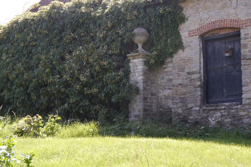
Pair of piers about 8 metres apart. C18. Rubble with stone dressings.
Square plan. Rubble piers with freestone cornice, pedestal and large ball
finial with Greek key pattern round circumference of ball.
Listing NGR: ST5765388930
External links are from the relevant listing authority and, where applicable, Wikidata. Wikidata IDs may be related buildings as well as this specific building. If you want to add or update a link, you will need to do so by editing the Wikidata entry.


Other nearby listed buildings