Latitude: 51.3853 / 51°23'7"N
Longitude: -2.779 / 2°46'44"W
OS Eastings: 345889
OS Northings: 165428
OS Grid: ST458654
Mapcode National: GBR JG.RZNG
Mapcode Global: VH7CG.SF7W
Plus Code: 9C3V96PC+4C
Entry Name: School
Listing Date: 20 January 1986
Grade: II
Source: Historic England
Source ID: 1136592
English Heritage Legacy ID: 33693
ID on this website: 101136592
Location: Cleeve, North Somerset, BS49
County: North Somerset
Civil Parish: Cleeve
Built-Up Area: Cleeve
Traditional County: Somerset
Lieutenancy Area (Ceremonial County): Somerset
Tagged with: School building
CLEEVE C.P. PLUNDER STREET (north west side) ST 46 NE 6/28 School G.V. II
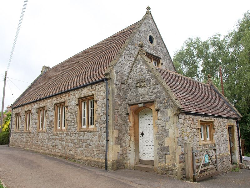
School, now in public use. Early - mid C19. Snecked limestone rubble, stone dressings and quoins, plain tiled roof with raised coped verges and finials to gables. T-plan. Central single storey hall has five 2-light casements, 6 panes each, with ovolo-moulded mullions and hood moulds, plinth; small gabled porch to left and right, each with 4-centred arched chamfered doorway with hood mould, studded doors, labelled boys to left and girls to right. Left and right returns each have smaller similar 2-light casement and door in porch, 2-light casement and oculus in gable end; rear has 2-storey gabled wing, rest of building not accessible.
Listing NGR: ST4588965428
External links are from the relevant listing authority and, where applicable, Wikidata. Wikidata IDs may be related buildings as well as this specific building. If you want to add or update a link, you will need to do so by editing the Wikidata entry.


Other nearby listed buildings