Approximate Location Map
Large Map »
Latitude: 50.2158 / 50°12'57"N
Longitude: -5.4772 / 5°28'37"W
OS Eastings: 152034
OS Northings: 40879
OS Grid: SW520408
Mapcode National: GBR DXV3.PXM
Mapcode Global: VH12F.0TSX
Plus Code: 9C2P6G8F+84
Entry Name: 83, Back Road
Listing Date: 22 December 1972
Grade: II
Source: Historic England
Source ID: 1136728
English Heritage Legacy ID: 68928
ID on this website: 101136728
Location: St Ives, Cornwall, TR26
County: Cornwall
Civil Parish: St. Ives
Built-Up Area: St Ives
Traditional County: Cornwall
Lieutenancy Area (Ceremonial County): Cornwall
Church of England Parish: St Ives
Church of England Diocese: Truro
Tagged with: Building
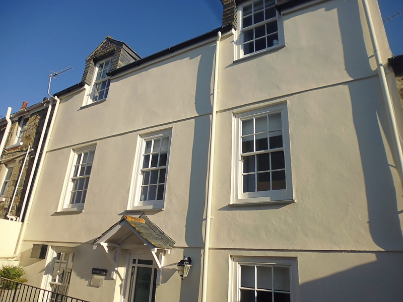
BACK ROAD
1. (North Side)
1587 ------------
No 83
SW 54 SW 1/32
II GV
2.
Early C19. Pebble-dashed rubble. Band at first and second floors. Three
storeys. Two modern casements, modern central door. Two modern flat roofed
dormers. Slate roof. Group value only.
The listed buildings from No 65 to No 93A form a group.
Listing NGR: SW5203440879
External links are from the relevant listing authority and, where applicable, Wikidata. Wikidata IDs may be related buildings as well as this specific building. If you want to add or update a link, you will need to do so by editing the Wikidata entry.


Other nearby listed buildings
