Approximate Location Map
Large Map »
Latitude: 50.2116 / 50°12'41"N
Longitude: -5.4817 / 5°28'53"W
OS Eastings: 151692
OS Northings: 40421
OS Grid: SW516404
Mapcode National: GBR DXV3.V7F
Mapcode Global: VH12D.XYX5
Plus Code: 9C2P6G69+J8
Entry Name: 7, Chapel Street
Listing Date: 22 December 1972
Grade: II
Source: Historic England
Source ID: 1136759
English Heritage Legacy ID: 68949
ID on this website: 101136759
Location: St Ives, Cornwall, TR26
County: Cornwall
Civil Parish: St. Ives
Built-Up Area: St Ives
Traditional County: Cornwall
Lieutenancy Area (Ceremonial County): Cornwall
Church of England Parish: St Ives
Church of England Diocese: Truro
Tagged with: Building
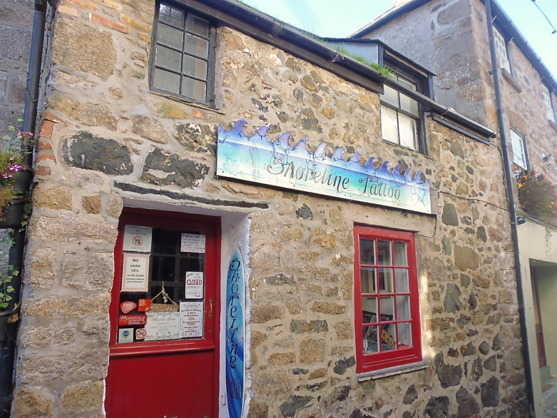
CHAPEL STREET
1. -------------
1587 Nos 7
SW 54 SW 1/51
II GV
2.
Probably early C18. Rubble cottage. Two storeys. Two windows, sashes,
no glazing bars, casement over door with glazing bars Flat roof dormer
window through eaves. Steep slate roof with gable end slate hung.
Premises of Harveys No 7 and Drill Hall in Chapel Street, with Nos 22,
23, 23A, 24 Street-An Garrow form a group.
Listing NGR: SW5169240421
External links are from the relevant listing authority and, where applicable, Wikidata. Wikidata IDs may be related buildings as well as this specific building. If you want to add or update a link, you will need to do so by editing the Wikidata entry.


Other nearby listed buildings
