Approximate Location Map
Large Map »
Latitude: 50.2118 / 50°12'42"N
Longitude: -5.4817 / 5°28'54"W
OS Eastings: 151692
OS Northings: 40440
OS Grid: SW516404
Mapcode National: GBR DXV3.V61
Mapcode Global: VH12D.XYX1
Plus Code: 9C2P6G69+P8
Entry Name: 3, Street-An-Garrow
Listing Date: 22 December 1972
Grade: II
Source: Historic England
Source ID: 1143297
English Heritage Legacy ID: 69103
ID on this website: 101143297
Location: St Ives, Cornwall, TR26
County: Cornwall
Civil Parish: St. Ives
Built-Up Area: St Ives
Traditional County: Cornwall
Lieutenancy Area (Ceremonial County): Cornwall
Church of England Parish: St Ives
Church of England Diocese: Truro
Tagged with: Building
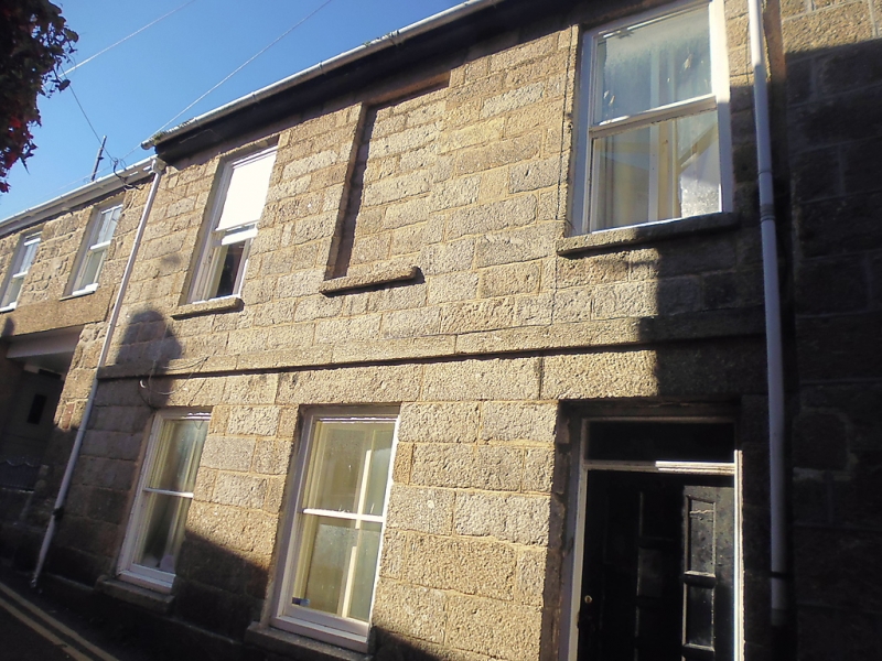
STREET-AN-GARROW
1. (North Side)
1587 ----------------
No 5
SW 54 SW 1/141
II GV
2.
Early C19. Cut granite blocks. stringcourse at first floor level. Two
storeys. Three windows, centre blocked, sashes with glazing bars. Panelled
door, plain rectangular fanlight. Slate roof, overhanging eaves.
Nos 3, 4, 5, 6, 8, 8A form a group.
Listing NGR: SW5169240440
External links are from the relevant listing authority and, where applicable, Wikidata. Wikidata IDs may be related buildings as well as this specific building. If you want to add or update a link, you will need to do so by editing the Wikidata entry.


Other nearby listed buildings
