Approximate Location Map
Large Map »
Latitude: 50.2138 / 50°12'49"N
Longitude: -5.4805 / 5°28'49"W
OS Eastings: 151788
OS Northings: 40666
OS Grid: SW517406
Mapcode National: GBR DXV3.NG6
Mapcode Global: VH12D.YWKG
Plus Code: 9C2P6G79+GR
Entry Name: 32 and 34, Fore Street
Listing Date: 22 December 1972
Grade: II
Source: Historic England
Source ID: 1136811
English Heritage Legacy ID: 68996
ID on this website: 101136811
Location: St Ives, Cornwall, TR26
County: Cornwall
Civil Parish: St. Ives
Built-Up Area: St Ives
Traditional County: Cornwall
Lieutenancy Area (Ceremonial County): Cornwall
Church of England Parish: St Ives
Church of England Diocese: Truro
Tagged with: Building
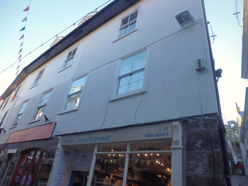
FOER STREET
1. (West Side)
1587 -----------
Nos 32 and 34
SW 54 SW 1/76
II GV
2.
C18/19 Granite rubble, stuccoed above ground floor. Three storey,
four windows overall, sashes in moulded cases, some have galzing bars.
Wide ground floor windows with segmental arches, Victorian shop to
No 34. overhanging eaves. slate roof with hipped end.
Nos 30, 32 and 34 form a group.
Listing NGR: SW5178840666
External links are from the relevant listing authority and, where applicable, Wikidata. Wikidata IDs may be related buildings as well as this specific building. If you want to add or update a link, you will need to do so by editing the Wikidata entry.


Other nearby listed buildings
