Approximate Location Map
Large Map »
Latitude: 50.2138 / 50°12'49"N
Longitude: -5.48 / 5°28'48"W
OS Eastings: 151821
OS Northings: 40664
OS Grid: SW518406
Mapcode National: GBR DXV3.NNS
Mapcode Global: VH12D.YWSG
Plus Code: 9C2P6G79+GX
Entry Name: Harbour Amusements
Listing Date: 22 December 1972
Grade: II
Source: Historic England
Source ID: 1327834
English Heritage Legacy ID: 69152
ID on this website: 101327834
Location: St Ives, Cornwall, TR26
County: Cornwall
Civil Parish: St. Ives
Built-Up Area: St Ives
Traditional County: Cornwall
Lieutenancy Area (Ceremonial County): Cornwall
Church of England Parish: St Ives
Church of England Diocese: Truro
Tagged with: Architectural structure
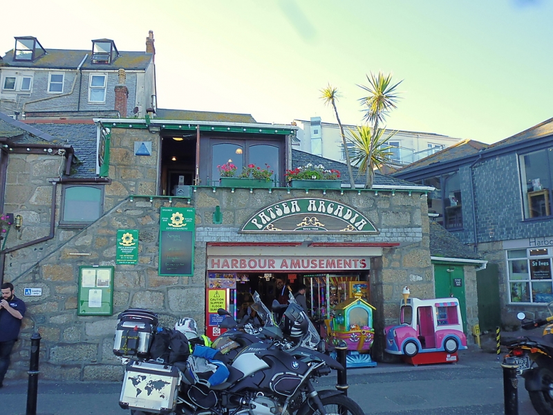
THE WHARF
1. ---------
1587 Harbour Amusements
SW 54 SW 1/181
II GV
2.
C18 granite rubble. Two storeys with external stone steps up to central
first floor doorway and balcony with garage doorway underneath. Two windows
large modern three-light windows. Slurried slate hipped roof. Group value
Both premises of Harbour Amusements form a group.
Listing NGR: SW5182140664
External links are from the relevant listing authority and, where applicable, Wikidata. Wikidata IDs may be related buildings as well as this specific building. If you want to add or update a link, you will need to do so by editing the Wikidata entry.


Other nearby listed buildings
