Approximate Location Map
Large Map »
Latitude: 54.2097 / 54°12'35"N
Longitude: -2.7737 / 2°46'25"W
OS Eastings: 349638
OS Northings: 479610
OS Grid: SD496796
Mapcode National: GBR 9M2R.9P
Mapcode Global: WH83G.CGG2
Plus Code: 9C6V665G+VG
Entry Name: Parsonage Farmhouse and Attached Stores to North
Listing Date: 21 November 1952
Grade: II
Source: Historic England
Source ID: 1137509
English Heritage Legacy ID: 76550
ID on this website: 101137509
Location: Beetham, Westmorland and Furness, Cumbria, LA7
County: Cumbria
District: South Lakeland
Civil Parish: Beetham
Traditional County: Westmorland
Lieutenancy Area (Ceremonial County): Cumbria
Church of England Parish: Beetham St Michael and All Angels
Church of England Diocese: Carlisle
Tagged with: Farmhouse
SD 4979 BEETHAM A6 (off West side)
Beetham
9/7 Parsonage Farmhouse
and attached stores
21.11.52 to North
G.V. II
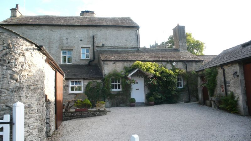
Farmhouse. Probably late C17 with later additions and extensions. South part
appears to incorporate remains of medieval college demolished in 1756 (R.C.H.M.)
of which blocked doorway in South wall is visible. Slobbered rubble walls with
roughly-cut limestone quoins; graduated greenslate roof with stone ridge. 2
storeys plus attics. Main frontage in East gable: 4 windows, irregular, mostly
C19 cross windows with leaded glazing. Off-centre boarded door. Ground-floor
window to far right small-paned; attic window at top left trompe-l'oeil.
Blocked medieval doorway in South wall has 2-centred head. Massive chimney with
round shafts offset from ridge to South; single chimney in apex of East gable.
Interior has 2 staircases, one with turned balusters and square newels;
panelling to rear ground-floor drawing room; panelled partitions, one with
initials and date R & IA 1661; cornices to upper-floor rooms; powder room
backing onto landing. See also R.C.H.M. p.104, although part of the panelling
described therein has since been removed.
Listing NGR: SD4964179605
External links are from the relevant listing authority and, where applicable, Wikidata. Wikidata IDs may be related buildings as well as this specific building. If you want to add or update a link, you will need to do so by editing the Wikidata entry.


Other nearby listed buildings
