Latitude: 54.5202 / 54°31'12"N
Longitude: -1.2594 / 1°15'33"W
OS Eastings: 448036
OS Northings: 514132
OS Grid: NZ480141
Mapcode National: GBR MJN5.4D
Mapcode Global: WHD75.MNH3
Plus Code: 9C6WGPCR+36
Entry Name: The Stainton Public House
Listing Date: 28 July 1988
Grade: II
Source: Historic England
Source ID: 1137526
English Heritage Legacy ID: 59843
Also known as: Stainton
The Stainton, Stainton, Middlesbrough
ID on this website: 101137526
Location: Stainton, Middlesbrough, North Yorkshire, TS8
County: Middlesbrough
Civil Parish: Stainton and Thornton
Built-Up Area: Middlesbrough
Traditional County: Yorkshire
Lieutenancy Area (Ceremonial County): North Yorkshire
Church of England Parish: Stainton-in-Cleveland St Peter and St Paul
Church of England Diocese: York
Tagged with: Pub
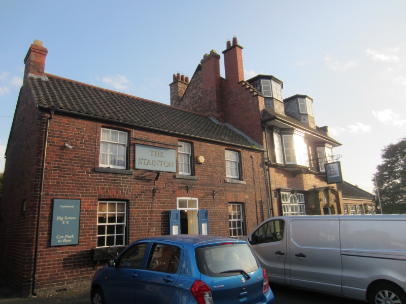
STAINTON AND MELDYKE LANE,
NZ 41 SE (4814)
THORNTON east side.
5/121 The Stainton public
house
- II.
Public house, date 1897, and mid-C20 right extension. Smooth red brick,
pebbledash on first floor, and sandstone ashlar porch. Plain clay tiled
roof with stone gable copings. Clay pantiles on extension, with concrete
gable copings and dressings. 2 storeys, 2 windows. Central, projecting,
wavy-gabled porch with panelled part-glazed doors set behind wrought iron
gate, with scrolled panels, in moulded basket-headed surround with applied
metal letters: "1897" flanking giant keystone. Short diagonal buttresses at
angles of porch. Slightly-projecting casement windows with glazing bars and
wood cornices: 3-light, with round-headed centre, on ground-floor left;
one-light on ground-floor right; 5-light, the middle 3 canted, on wood
bracket, on first floor left; and 3-light at right. Continuous egg-and-dart
sill mouldings. Scrolled wrought-iron bracketed sign between bays on first
floor. Deep plain soffit. 2 canted flat-roofed dormers with similar
windows and cornices. End stacks. Lower part of left gable crowstepped.
One-storey right extension has tripartite casement window at left of
part-glazed double doors, in flat surrounds. Rear one-storey extension
is not of special interest.
Listing NGR: NZ4803614132
External links are from the relevant listing authority and, where applicable, Wikidata. Wikidata IDs may be related buildings as well as this specific building. If you want to add or update a link, you will need to do so by editing the Wikidata entry.


Other nearby listed buildings