Approximate Location Map
Large Map »
Latitude: 51.3541 / 51°21'14"N
Longitude: -2.9853 / 2°59'7"W
OS Eastings: 331484
OS Northings: 162133
OS Grid: ST314621
Mapcode National: GBR J6.TV3J
Mapcode Global: VH7CK.67N8
Plus Code: 9C3V9237+MV
Entry Name: Villa Rosa Bridge
Listing Date: 19 May 1983
Grade: II
Source: Historic England
Source ID: 1137806
English Heritage Legacy ID: 33228
ID on this website: 101137806
Location: North Somerset, BS23
County: North Somerset
Civil Parish: Weston-super-Mare
Built-Up Area: Weston-Super-Mare
Traditional County: Somerset
Lieutenancy Area (Ceremonial County): Somerset
Tagged with: Bridge
SHRUBBERY ROAD
1.
5121
Villa Rosa Bridge
ST 3162 4/44
II
2.
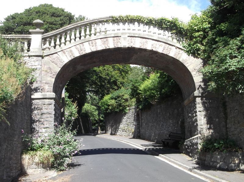
Late 1850's. Elliptical arch, ornamental footbridge spanning Shrubbery Road. Rubble
with freestone balustrade. Alternating rubble and ashlar voussoirs. Built to
re-connect the parts of the Villa Rosa gardens severed by the building of Shrubbery
Road.
Listing NGR: ST3148462133
External links are from the relevant listing authority and, where applicable, Wikidata. Wikidata IDs may be related buildings as well as this specific building. If you want to add or update a link, you will need to do so by editing the Wikidata entry.


Other nearby listed buildings
