Approximate Location Map
Large Map »
Latitude: 54.3255 / 54°19'31"N
Longitude: -2.7478 / 2°44'51"W
OS Eastings: 351463
OS Northings: 492476
OS Grid: SD514924
Mapcode National: GBR 9L7F.X5
Mapcode Global: WH82W.RJQT
Plus Code: 9C6V87G2+6V
Entry Name: 96, Highgate
Listing Date: 14 April 1969
Grade: II
Source: Historic England
Source ID: 1137875
English Heritage Legacy ID: 75400
ID on this website: 101137875
Location: Kirkbarrow, Westmorland and Furness, Cumbria, LA9
County: Cumbria
District: South Lakeland
Civil Parish: Kendal
Built-Up Area: Kendal
Traditional County: Westmorland
Lieutenancy Area (Ceremonial County): Cumbria
Church of England Parish: Kendal Holy Trinity
Church of England Diocese: Carlisle
Tagged with: Building
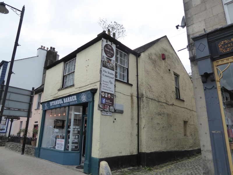
SD 5192 SW KENDAL HIGHGATE
(West side)
10/59 No 96
14-4-69
G.V. II
Shop, adjoining north end of New Inn at right-angles. Possibly mid C17 with
C18/C19 additions. Wet-dashed rubble. Hipped, graduated slate roof. 2
storeys, single bay. Part-glazed door and plate-glass window in corniced C19
shop front with panelled pilasters; 16-pane sash above.
Listing NGR: SD5146392476
External links are from the relevant listing authority and, where applicable, Wikidata. Wikidata IDs may be related buildings as well as this specific building. If you want to add or update a link, you will need to do so by editing the Wikidata entry.


Other nearby listed buildings
