Latitude: 53.1865 / 53°11'11"N
Longitude: -2.1116 / 2°6'41"W
OS Eastings: 392639
OS Northings: 365490
OS Grid: SJ926654
Mapcode National: GBR 23M.6YV
Mapcode Global: WHBC2.J5PJ
Plus Code: 9C5V5VPQ+H9
Entry Name: Road Bridge Opposite East End of Reservoir Dam
Listing Date: 14 June 1984
Grade: II
Source: Historic England
Source ID: 1138906
English Heritage Legacy ID: 58117
Also known as: Bridge near Reservoir Dam
ID on this website: 101138906
Location: Bosley, Cheshire East, Cheshire, SK11
County: Cheshire East
Civil Parish: Bosley
Traditional County: Cheshire
Lieutenancy Area (Ceremonial County): Cheshire
Church of England Parish: Bosley St Mary the Virgin
Church of England Diocese: Chester
Tagged with: Bridge
BOSLEY C.P. BOSLEY RESERVOIR SJ 96 NW 1/2 Road Bridge opposite east end of Reservoir Dam
GV II
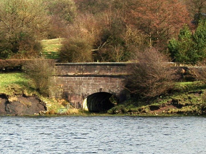
Roadbridge circa.1830 probably by William Crosley engineer, of tooled ashlar reddish-buff sandstone. Horseshoe elliptical arch with keystones. Abutments are curved in plan and battered. Plain projecting strings at road level carry stone parapets with plain projecting copings, terminating in square piers. In form and detailing the bridge is similar to those on the Macclesfield Canal.
Listing NGR: SJ9263965490
External links are from the relevant listing authority and, where applicable, Wikidata. Wikidata IDs may be related buildings as well as this specific building. If you want to add or update a link, you will need to do so by editing the Wikidata entry.


Other nearby listed buildings