Latitude: 53.2833 / 53°16'59"N
Longitude: -2.12 / 2°7'11"W
OS Eastings: 392098
OS Northings: 376262
OS Grid: SJ920762
Mapcode National: GBR FZMG.TR
Mapcode Global: WHBBH.DQQV
Plus Code: 9C5V7VMJ+82
Entry Name: Cold Arbour Farmhouse
Listing Date: 9 December 1983
Grade: II
Source: Historic England
Source ID: 1138960
English Heritage Legacy ID: 57938
ID on this website: 101138960
Location: Bollington Cross, Cheshire East, Cheshire, SK10
County: Cheshire East
Civil Parish: Bollington
Built-Up Area: Macclesfield
Traditional County: Cheshire
Lieutenancy Area (Ceremonial County): Cheshire
Church of England Parish: Bollington
Church of England Diocese: Chester
Tagged with: Farmhouse
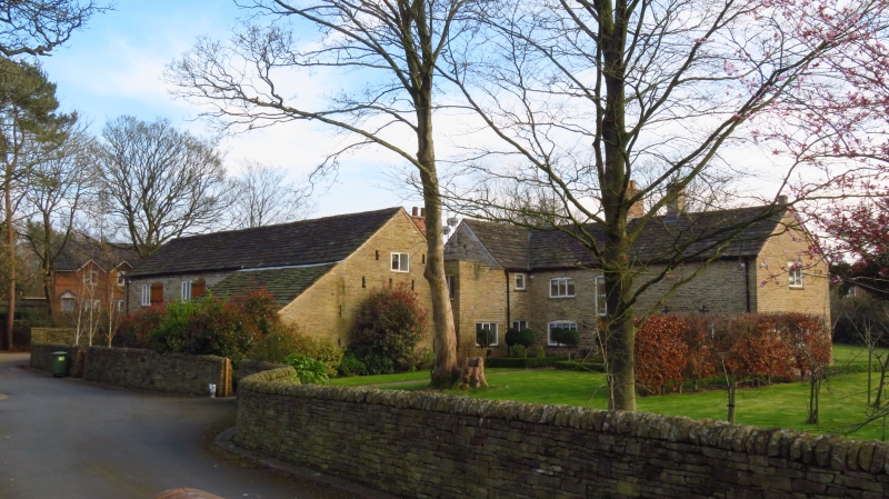
SJ 97 NW BOLLINGTON CLARKE LANE (South Side)
2/21 Cold Arbour Farmhouse.
GV II
Formerly farmhouse now house: C16 origins, C17 additions and mid C18 alterations. Coursed, squared buff sandstone rubble. Kerridge stone-slate roof, stone ridge, a brick and a stone chimney. L-shaped in plan with internal cross passage, with former farm building to the right. 2-storey, 3-bay north front with rough stone cambered heads with a prominent keystone in end bays, lower storeys holding 4-light fixed small pane iron casements with small 6-light openings. Similar blocked opening above to left only. Near central 8-panelled door (partly with moulded hexagons) under stone lintel with mullioned and transomed iron, small pane window immediately above, under cambered stone head. To the left, the gabled parlour wing has been extended to the barn but shows a small circular light. Interior: Rooms to left of cross passage have exposed small-framed, timber partitions. Main room has massive chamfered beam with carved stops. Other rooms have lighter chamfered beams with flat stops. Mid C18 turned baluster stair in cross passage and part of stone ladder to former hayloft.
Listing NGR: SJ9209876262
External links are from the relevant listing authority and, where applicable, Wikidata. Wikidata IDs may be related buildings as well as this specific building. If you want to add or update a link, you will need to do so by editing the Wikidata entry.


Other nearby listed buildings