Latitude: 54.5611 / 54°33'40"N
Longitude: -1.0627 / 1°3'45"W
OS Eastings: 460708
OS Northings: 518835
OS Grid: NZ607188
Mapcode National: GBR PH0P.QR
Mapcode Global: WHF86.NM47
Plus Code: 9C6WHW6P+CW
Entry Name: Boundary Wall and Gatepiers to West of Dunsdale Farmhouse
Listing Date: 25 April 1984
Grade: II
Source: Historic England
Source ID: 1139756
English Heritage Legacy ID: 60009
ID on this website: 101139756
Location: Dunsdale, Redcar and Cleveland, North Yorkshire, TS14
County: Redcar and Cleveland
Civil Parish: Guisborough
Traditional County: Yorkshire
Lieutenancy Area (Ceremonial County): North Yorkshire
Church of England Parish: Kirkleatham
Church of England Diocese: York
Tagged with: Wall
NZ61NW GUISBOROUGH REDCAR ROAD
(east side)
DUNSDALE VILLAGE
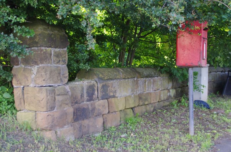
3/151 Boundary wall
and gatepiers
to W. of Dunsdale
Farmhouse
GV II
Early C.19 boundary wall and gatepiers fronting onto Redcar Road.
Rockfaced sandstone.
Listing NGR: NZ6070818835
External links are from the relevant listing authority and, where applicable, Wikidata. Wikidata IDs may be related buildings as well as this specific building. If you want to add or update a link, you will need to do so by editing the Wikidata entry.


Other nearby listed buildings