Approximate Location Map
Large Map »
Latitude: 50.4532 / 50°27'11"N
Longitude: -4.4129 / 4°24'46"W
OS Eastings: 228802
OS Northings: 64262
OS Grid: SX288642
Mapcode National: GBR NJ.NSBK
Mapcode Global: FRA 17NV.LLT
Plus Code: 9C2QFH3P+7R
Entry Name: Wheal Honey Stack
Listing Date: 26 November 1985
Grade: II
Source: Historic England
Source ID: 1140023
English Heritage Legacy ID: 61300
ID on this website: 101140023
Location: Cornwall, PL14
County: Cornwall
Civil Parish: Menheniot
Traditional County: Cornwall
Lieutenancy Area (Ceremonial County): Cornwall
Church of England Parish: Menheniot
Church of England Diocese: Truro
Tagged with: Architectural structure
SX 26 SE MENHENIOT
11/97 Wheal Honey Stack
II
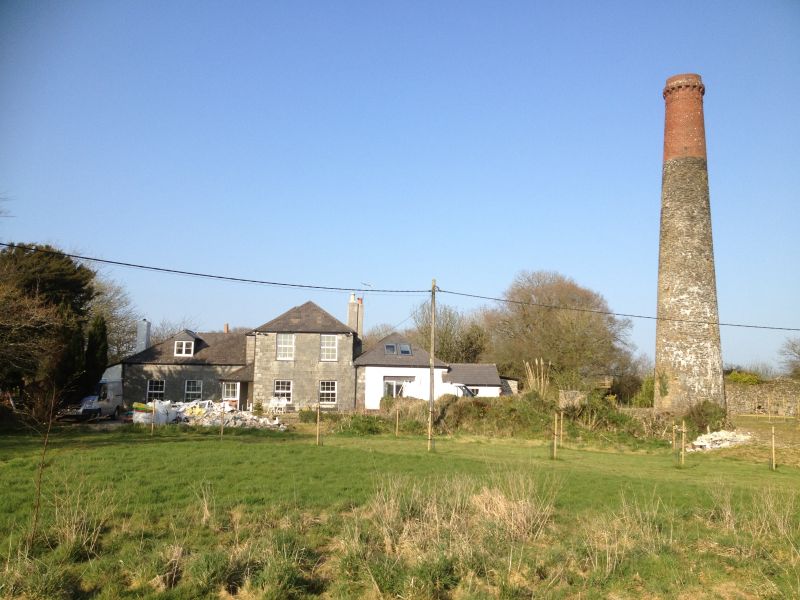
Mine chimney. Circa mid C19. Rubblestone and brick. Tall tapering round stack of
rubblestone with upper third continued in red brick. Corbelled brick cornice.
Noticeable landmark. Work at the mine commenced in 1845 and continued until 1871 as
Wheal Trelawny. 1883-4 as Hony and Trelawny.
Listing NGR: SX2880264262
External links are from the relevant listing authority and, where applicable, Wikidata. Wikidata IDs may be related buildings as well as this specific building. If you want to add or update a link, you will need to do so by editing the Wikidata entry.


Other nearby listed buildings
