Approximate Location Map
Large Map »
Latitude: 52.9642 / 52°57'51"N
Longitude: -1.4108 / 1°24'38"W
OS Eastings: 439672
OS Northings: 340919
OS Grid: SK396409
Mapcode National: GBR 6DK.446
Mapcode Global: WHDGN.9RFG
Plus Code: 9C4WXH7Q+MM
Entry Name: Churchyard Cross
Listing Date: 6 November 1986
Grade: II
Source: Historic England
Source ID: 1140414
English Heritage Legacy ID: 352282
ID on this website: 101140414
Location: St Matthew's Church, Morley, Erewash, Derbyshire, DE7
County: Derbyshire
District: Erewash
Civil Parish: Morley
Traditional County: Derbyshire
Lieutenancy Area (Ceremonial County): Derbyshire
Church of England Parish: Morley St Matthew
Church of England Diocese: Derby
Tagged with: Churchyard cross
PARISH OF MORLEY CHURCH LANE
SK 34 SE
1/79 (North Side)
Churchyard Cross
GV II
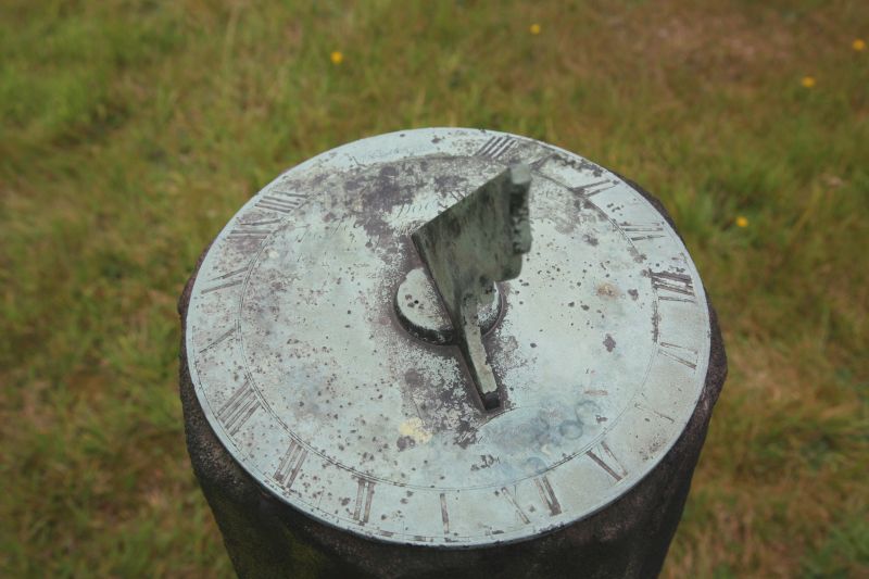
Churchyard cross. Medieval, made into sundial in 1762 by
Whitehurst of Derby. Gritstone. Polygonal base and polygonal
shaft, about four feet high. Sundial with base plate and
gnomon.
Listing NGR: SK3967240919
External links are from the relevant listing authority and, where applicable, Wikidata. Wikidata IDs may be related buildings as well as this specific building. If you want to add or update a link, you will need to do so by editing the Wikidata entry.


Other nearby listed buildings
