Approximate Location Map
Large Map »
Latitude: 50.1908 / 50°11'26"N
Longitude: -5.1804 / 5°10'49"W
OS Eastings: 173085
OS Northings: 37153
OS Grid: SW730371
Mapcode National: GBR Z6.44BF
Mapcode Global: FRA 081J.7LN
Plus Code: 9C2P5RR9+8V
Entry Name: Churchyard Walls to West, North and East of Church of St Stedian
Listing Date: 17 June 1988
Grade: II
Source: Historic England
Source ID: 1142026
English Heritage Legacy ID: 66270
ID on this website: 101142026
Location: St Stythian's Church, Hendra, Cornwall, TR3
County: Cornwall
Civil Parish: Stithians
Built-Up Area: Stithians
Traditional County: Cornwall
Lieutenancy Area (Ceremonial County): Cornwall
Church of England Parish: Stithians
Church of England Diocese: Truro
Tagged with: Churchyard wall
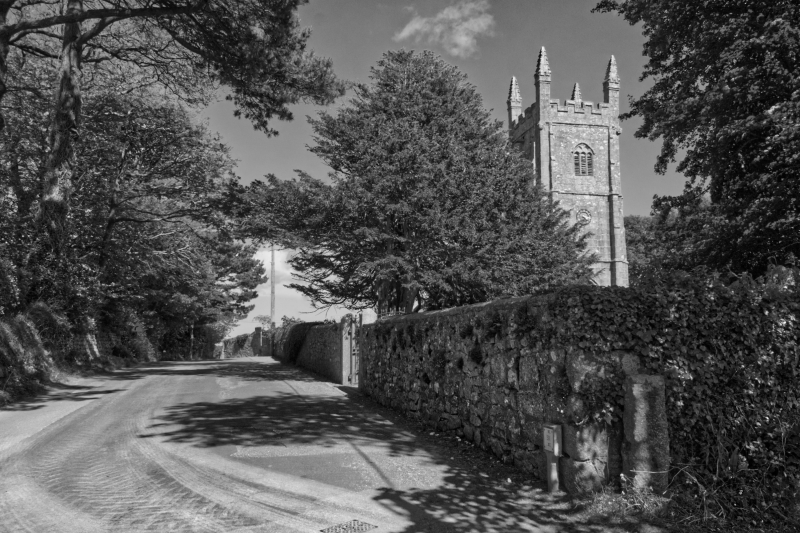
SW 73 NW STITHIANS STITHIANS
2/284 Churchyard walls to west, north and
- east of Church of St Stedian
GV II
Churchyard walls. C18 and C19. Granite rubble with dressed granite hog's back
copings.
Listing NGR: SW7308537153
External links are from the relevant listing authority and, where applicable, Wikidata. Wikidata IDs may be related buildings as well as this specific building. If you want to add or update a link, you will need to do so by editing the Wikidata entry.


Other nearby listed buildings
