Latitude: 50.244 / 50°14'38"N
Longitude: -5.1868 / 5°11'12"W
OS Eastings: 172880
OS Northings: 43086
OS Grid: SW728430
Mapcode National: GBR Z6.0NNM
Mapcode Global: FRA 080D.53F
Plus Code: 9C2P6RV7+J7
Entry Name: Tregullow Lodge with Associated Gatepiers
Listing Date: 12 September 1989
Grade: II
Source: Historic England
Source ID: 1142532
English Heritage Legacy ID: 66930
ID on this website: 101142532
Location: Tolgullow, Cornwall, TR16
County: Cornwall
Civil Parish: St. Day
Built-Up Area: St Day
Traditional County: Cornwall
Lieutenancy Area (Ceremonial County): Cornwall
Church of England Parish: St Day
Church of England Diocese: Truro
Tagged with: Architectural structure
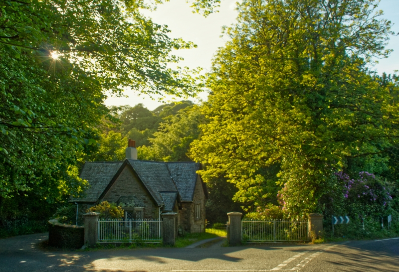
ST DAY TOLGULLOW SW 74 SW (west side of B3298) 6/363 Tregullow Lodge with associated gatepiers II Lodge to Tregullow House. c.1830. Killas rubble brought to courses, with granite dressings, slate roof. Roughly cruciform plan formed by 2-unit main range with short wings to front and rear plus a lean-to in the rear angle. Tudor style. Single storey; raised quoins and raised surrounds to openings; the north front (to drive) has a gabled porch to the left, with chamfered 4-centred arched doorway, and a single-light window to the right of this; and the short projecting wing to the right has a 3-light mullioned window. Chimney stack behind ridge. The east gable wall has a small canted bay with 4-light mullioned window, the west gable has a 3-light window, and the rear wing has a single light window in its south side and a door in the gable wall. All windows have chamfered reveals and most have diamond leaded glazing. Interior: 3-room plan, plus a half-sunk scullery in the lean-to. Gatepiers approx. 5 metres east: a set of 4 sturdy monoliths approx. ½ metre square and 2 metres high, with shallow pyramidal caps, the inner and outer piers linked by unusual stone railings with narrow round-headed openings and rounded coping.
Listing NGR: SW7288043086
External links are from the relevant listing authority and, where applicable, Wikidata. Wikidata IDs may be related buildings as well as this specific building. If you want to add or update a link, you will need to do so by editing the Wikidata entry.


Other nearby listed buildings