Approximate Location Map
Large Map »
Latitude: 50.2373 / 50°14'14"N
Longitude: -5.1943 / 5°11'39"W
OS Eastings: 172310
OS Northings: 42358
OS Grid: SW723423
Mapcode National: GBR Z6.10NP
Mapcode Global: FRA 080D.G6D
Plus Code: 9C2P6RP4+W7
Entry Name: Vogue Shute
Listing Date: 17 June 1991
Grade: II
Source: Historic England
Source ID: 1142537
English Heritage Legacy ID: 66944
ID on this website: 101142537
Location: Vogue, Cornwall, TR16
County: Cornwall
Civil Parish: St. Day
Built-Up Area: St Day
Traditional County: Cornwall
Lieutenancy Area (Ceremonial County): Cornwall
Church of England Parish: Redruth
Church of England Diocese: Truro
Tagged with: Architectural structure
The following building shall be added to the list:-
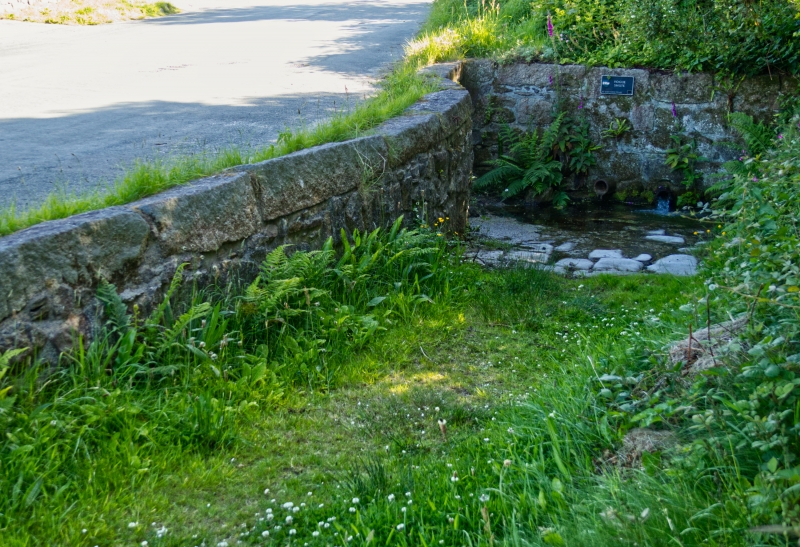
ST DAY VOGUE
SW 74 SW
6/376 Vogue Shute
II
Water shute. C17/19. Granite walls, on L-plan, of dressed
blocks laid to course. A very rare surviving example of a shute,
with its retaining wall built alongside the ramped access for
carts. Recorded in the manor papers from the C17, and the
principal source of drinking water for the community until the
1930's.
Listing NGR: SW7231042358
External links are from the relevant listing authority and, where applicable, Wikidata. Wikidata IDs may be related buildings as well as this specific building. If you want to add or update a link, you will need to do so by editing the Wikidata entry.


Other nearby listed buildings
