Approximate Location Map
Large Map »
Latitude: 50.1173 / 50°7'2"N
Longitude: -5.5347 / 5°32'4"W
OS Eastings: 147412
OS Northings: 30124
OS Grid: SW474301
Mapcode National: GBR DXQC.MM1
Mapcode Global: VH12Z.09WW
Plus Code: 9C2P4F88+W4
Entry Name: Turk's Head Inn
Listing Date: 7 February 1974
Grade: II
Source: Historic England
Source ID: 1143160
English Heritage Legacy ID: 69467
Also known as: Turks Head
ID on this website: 101143160
Location: Penzance, Cornwall, TR18
County: Cornwall
Civil Parish: Penzance
Built-Up Area: Penzance
Traditional County: Cornwall
Lieutenancy Area (Ceremonial County): Cornwall
Church of England Parish: Penzance St Mary the Virgin with St Paul
Church of England Diocese: Truro
Tagged with: Inn
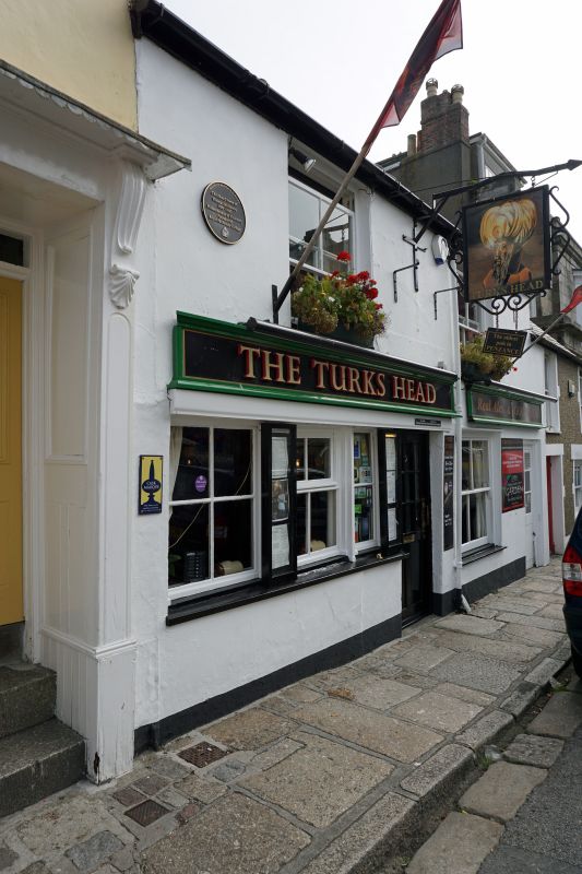
1.
1498 PENZANCE
CHAPEL STREET
(North East Side)
Turk's Head Inn
SW 4730 5/32B
II GV
2.
C18/19. Stucco. Slate roof. 2 storeys. 2 windows, sashes, no glazing bars.
3-light sash ground floor left and adjoining central door. Modern door to right.
Included for group value.
All listed buildings on the North East Side of Chapel Street form a group.
Listing NGR: SW4734930175
External links are from the relevant listing authority and, where applicable, Wikidata. Wikidata IDs may be related buildings as well as this specific building. If you want to add or update a link, you will need to do so by editing the Wikidata entry.


Other nearby listed buildings
