Approximate Location Map
Large Map »
Latitude: 50.2109 / 50°12'39"N
Longitude: -5.4831 / 5°28'58"W
OS Eastings: 151589
OS Northings: 40347
OS Grid: SW515403
Mapcode National: GBR DXV4.17Q
Mapcode Global: VH12D.XY6Q
Plus Code: 9C2P6G68+9Q
Entry Name: 5 and 6, the Stennack
Listing Date: 22 December 1972
Grade: II
Source: Historic England
Source ID: 1143296
English Heritage Legacy ID: 69101
ID on this website: 101143296
Location: St Ives, Cornwall, TR26
County: Cornwall
Civil Parish: St. Ives
Built-Up Area: St Ives
Traditional County: Cornwall
Lieutenancy Area (Ceremonial County): Cornwall
Church of England Parish: St Ives
Church of England Diocese: Truro
Tagged with: Building
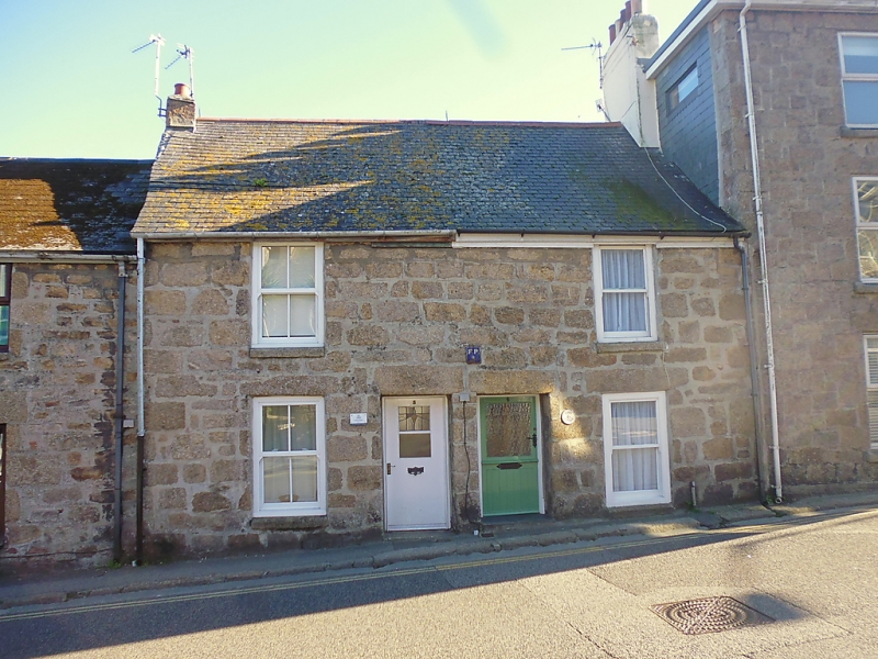
THE STENNACK
1. ------------
1587 Nos 5 Hiid 6
SW 54 SW 1/139
II GV
2.
C18 cottage. Coursed granite. Two storeys. Two windows, C19 sashes,
no glaring bars. Central doorway. Steep slurried slate roof. Group value.
Nos 1, 2, 3, 5, 6 and umfulla Place, form a group.
Listing NGR: SW5158940347
External links are from the relevant listing authority and, where applicable, Wikidata. Wikidata IDs may be related buildings as well as this specific building. If you want to add or update a link, you will need to do so by editing the Wikidata entry.


Other nearby listed buildings
