Latitude: 50.2126 / 50°12'45"N
Longitude: -5.4803 / 5°28'49"W
OS Eastings: 151793
OS Northings: 40534
OS Grid: SW517405
Mapcode National: GBR DXV3.VXW
Mapcode Global: VH12D.YXMC
Plus Code: 9C2P6G79+3V
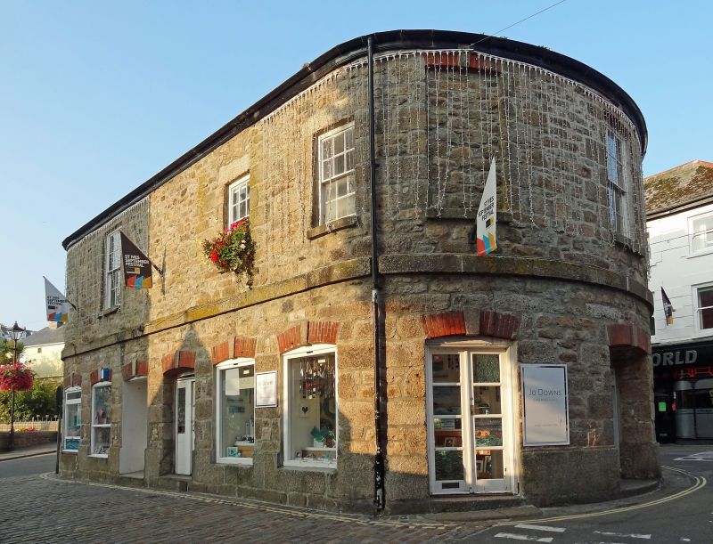
Entry Name: Market House
Listing Date: 22 December 1972
Grade: II
Source: Historic England
Source ID: 1143323
English Heritage Legacy ID: 69062
ID on this website: 101143323
Location: St Ives, Cornwall, TR26
County: Cornwall
Civil Parish: St. Ives
Built-Up Area: St Ives
Traditional County: Cornwall
Lieutenancy Area (Ceremonial County): Cornwall
Church of England Parish: St Ives
Church of England Diocese: Truro
Tagged with: House Magistrates' court Market hall Seat of local government
MARKET PLACE 1. ------------ 1587 Market House
SW 54 SW 1/112
II
2. Early C19. Granite rubble. Free standing. Rectangular building with round ends. Slate hipped roof. Central cupola with ball finial. Band at first floor level. Two storeys. Entrances and windows have red brick segmental arches with keystones. Datestone "1832".
Listing NGR: SW5179540532
External links are from the relevant listing authority and, where applicable, Wikidata. Wikidata IDs may be related buildings as well as this specific building. If you want to add or update a link, you will need to do so by editing the Wikidata entry.


Other nearby listed buildings