Approximate Location Map
Large Map »
Latitude: 50.1927 / 50°11'33"N
Longitude: -5.4678 / 5°28'3"W
OS Eastings: 152585
OS Northings: 38279
OS Grid: SW525382
Mapcode National: GBR DXW5.G88
Mapcode Global: VH12M.5FR3
Plus Code: 9C2P5GVJ+3V
Entry Name: Boskerris Farmhouse
Listing Date: 22 December 1972
Grade: II
Source: Historic England
Source ID: 1143336
English Heritage Legacy ID: 69090
ID on this website: 101143336
Location: Carbis Bay, Cornwall, TR26
County: Cornwall
Civil Parish: St. Ives
Built-Up Area: St Ives
Traditional County: Cornwall
Lieutenancy Area (Ceremonial County): Cornwall
Church of England Parish: Carbis Bay
Church of England Diocese: Truro
Tagged with: Farmhouse
ST IVES ROAD
1. CARBIS BAY
1587 ------------
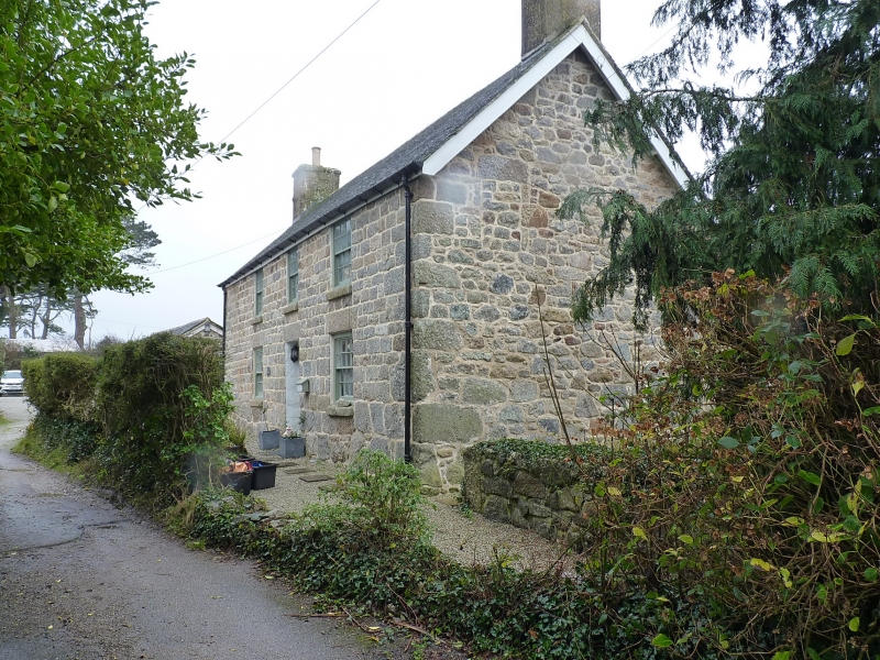
Boskerris Farmhouse
SW 53 NW 5/193
II
2.
Late C18 house . Coursed granite blocks. Two storeys. Three sash windows
with glazing bars. Central Panelled door. Slate roof with gable ends.
Listing NGR: SW5258538279
External links are from the relevant listing authority and, where applicable, Wikidata. Wikidata IDs may be related buildings as well as this specific building. If you want to add or update a link, you will need to do so by editing the Wikidata entry.


Other nearby listed buildings
